
Image: Surface weather map Tropical Depression Gert 1993

Size of this preview: 465 × 600 pixels. Other resolutions: 186 × 240 pixels | 850 × 1,096 pixels.
Original image (850 × 1,096 pixels, file size: 121 KB, MIME type: image/gif)
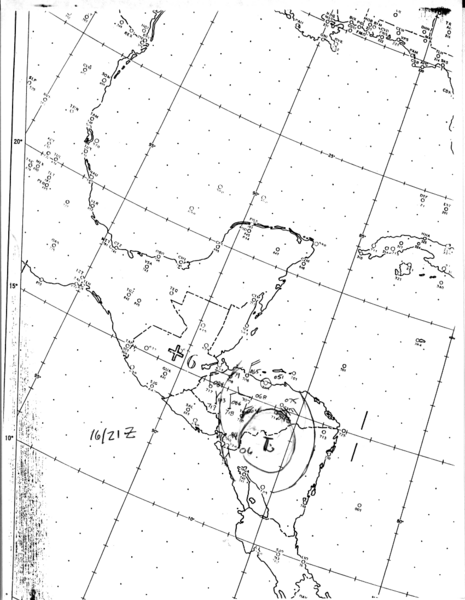
Description: The National Hurricane Center's surface weather analysis of Tropical Depression Gert inland near the Honduras-Nicaragua border at 2100 UTC on September 16, 1993.
Title: Surface weather map Tropical Depression Gert 1993
Credit: http://www.nhc.noaa.gov/archive/storm_wallets/atlantic/atl1993/gert/sfcmap/sfc1621z.gif
Author: National Hurricane Center
Usage Terms: Public domain
License: Public domain
Attribution Required?: No
Image usage
The following page links to this image:

All content from Kiddle encyclopedia articles (including the article images and facts) can be freely used under Attribution-ShareAlike license, unless stated otherwise.