
Image: Sweden 1280
Size of this preview: 486 × 600 pixels. Other resolutions: 194 × 240 pixels | 1,620 × 2,000 pixels.
Original image (1,620 × 2,000 pixels, file size: 176 KB, MIME type: image/png)
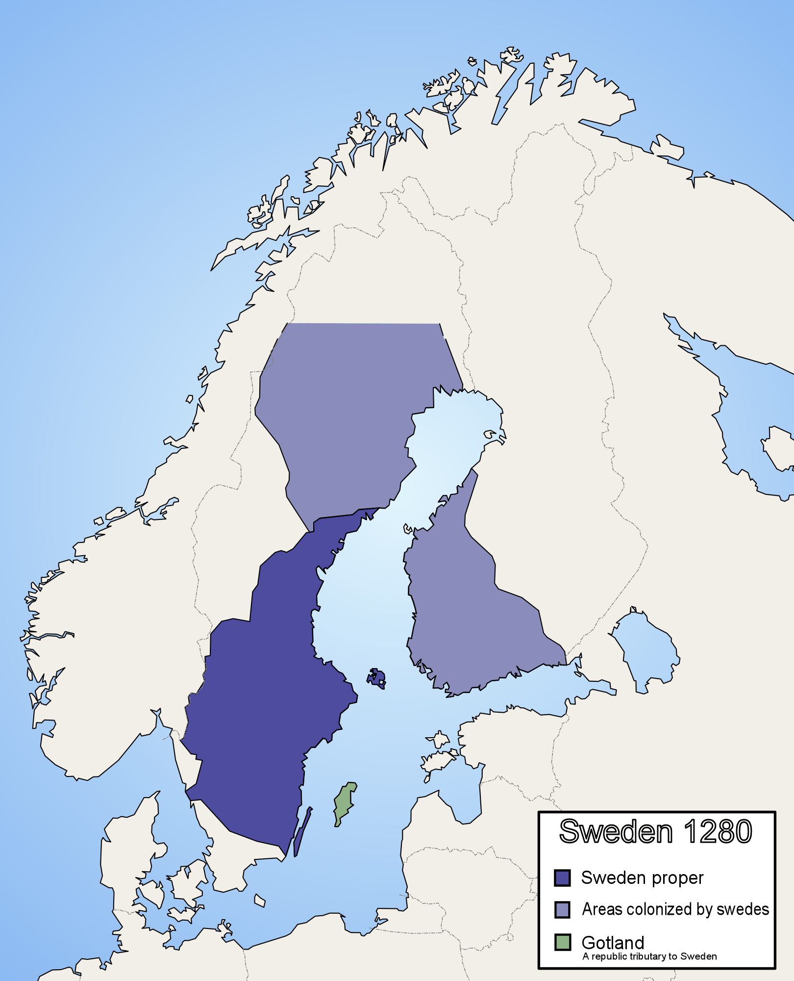
Description: This is a map of Sweden around the year 1280. Incorrect. The colonialization of Lappland (inner northern Sweden) did not start until 1670, and Norrbotten coast until some time after 1330. Hälsingland had a loose connection to Sweden until 1331. Created by Ningyou
Title: Sweden 1280
Credit: No machine-readable source provided. Own work assumed (based on copyright claims).
Author: No machine-readable author provided. Ningyou assumed (based on copyright claims).
Usage Terms: Public domain
License: Public domain
Attribution Required?: No
Image usage
The following page links to this image:

All content from Kiddle encyclopedia articles (including the article images and facts) can be freely used under Attribution-ShareAlike license, unless stated otherwise.