
Image: Sycamore Creek Michigan map
Size of this preview: 733 × 600 pixels. Other resolutions: 294 × 240 pixels | 2,850 × 2,331 pixels.
Original image (2,850 × 2,331 pixels, file size: 274 KB, MIME type: image/png)
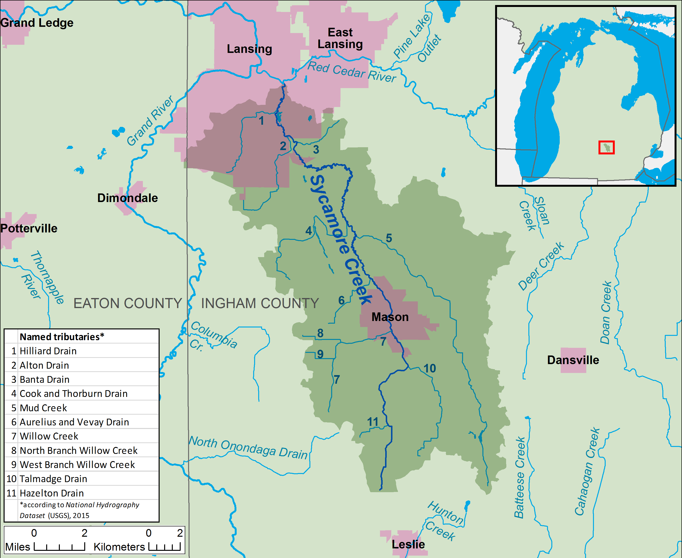
Description: A map of Sycamore Creek and its watershed (USGS HUC-12 codes 040500040505, 040500040506, and 040500040507) in Ingham County, Michigan. Shown are named streams within the Sycamore Creek watershed (as identified using the National Hydrography Dataset) and major streams outside the watershed.
Title: Sycamore Creek Michigan map
Credit: Own work, data from The National Map
Author: Tim Kiser (TimK MSI)
Usage Terms: Creative Commons Attribution-Share Alike 3.0
License: CC BY-SA 3.0
License Link: https://creativecommons.org/licenses/by-sa/3.0
Attribution Required?: Yes
Image usage
The following page links to this image:

All content from Kiddle encyclopedia articles (including the article images and facts) can be freely used under Attribution-ShareAlike license, unless stated otherwise.