
Image: Syrtis-Isidis zoom 64 pano
Size of this preview: 800 × 556 pixels. Other resolutions: 320 × 222 pixels | 3,600 × 2,500 pixels.
Original image (3,600 × 2,500 pixels, file size: 4.28 MB, MIME type: image/jpeg)
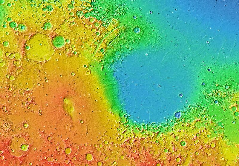
Description: Mars Orbiter Laser Altimeter (MOLA) colorized topographic map showing the impact basin Isidis Planitia (right) and the broad, low-lying shield volcano Syrtis Major Planum (left), just north of the equator in the eastern hemisphere of Mars. Isidis is the third largest of the obvious impact basins on the planet. The calderas Nili Patera (upper left) and Meroe Patera (lower right) are visible within the central region of Syrtis Major. Some of the features in this image are annotated in Wikimedia Commons.
Usage Terms: Public domain
Image usage
The following page links to this image:

All content from Kiddle encyclopedia articles (including the article images and facts) can be freely used under Attribution-ShareAlike license, unless stated otherwise.