
Image: Tancitaro
No higher resolution available.
Tancitaro.jpeg (600 × 450 pixels, file size: 53 KB, MIME type: image/jpeg)
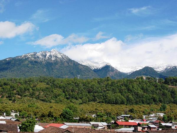
Description: Pico de Tancítaro (Volcán Tancítaro) — located in the Municipality of Tancítaro, State of Michoacán. At 3,845 metres (12,615 ft) in elevation, it is the highest point in the state.
Title: Tancitaro
Credit: Propia
Author: Unknown authorUnknown author
Usage Terms: Public domain
License: Public domain
Attribution Required?: No
Image usage
The following 2 pages link to this image:

All content from Kiddle encyclopedia articles (including the article images and facts) can be freely used under Attribution-ShareAlike license, unless stated otherwise.