
Image: Taum Sauk Pumped Storage

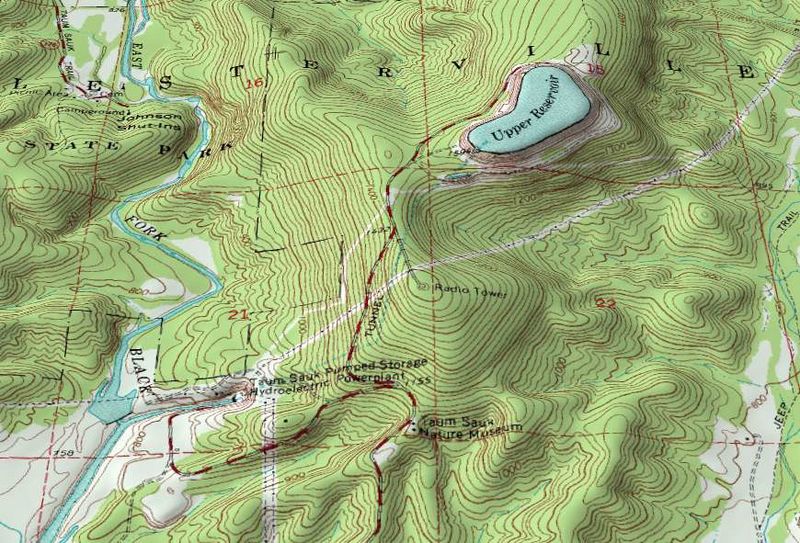
Description: An oblique topographic view of the Taum Sauk pumped storage plant. The upper reservoir failed in a catastrophic manner in 2005, destroying part of the neighboring state park. As of 2009 the electrical utility which owns the plant is planning to rebuild the reservoir. When operational, water from the East Fork Black River is pumped to the reservoir atop of Proffit Mountain at night. During periods of peak daytime demand the hydroelectric plant at the bottom of the mountain can use this to generate over 400MW of power. The water flows through a 7000-foot tunnel connecting the upper reservoir to the power plant. Water for pump-back is stored in a lower reservoir on the river (south of the bounds of this image). Johnson Shut-ins State Park is a short ways upstream from the power plant. For scale, the large numbered red squares (21, 22, etc.) on this topographic map are one square mile (2.6 km²) survey sections. Created by Kbh3rd for Wikipedia with public domain data from the USGS for the 7.5" Johnson Shutins, Missouri, topographic quadrangle (37090E7). This image was created with the 3DEM program. This image was originally uploaded to the English Wikipedia before being uploaded to Wikimedia Commons by the original uploader and copyright holder, Kbh3rd.
Title: Taum Sauk Pumped Storage
Credit: Own work
Author: Kbh3rd
Usage Terms: Creative Commons Attribution-Share Alike 3.0
License: CC BY-SA 3.0
License Link: https://creativecommons.org/licenses/by-sa/3.0
Attribution Required?: Yes
Image usage
The following page links to this image:
