
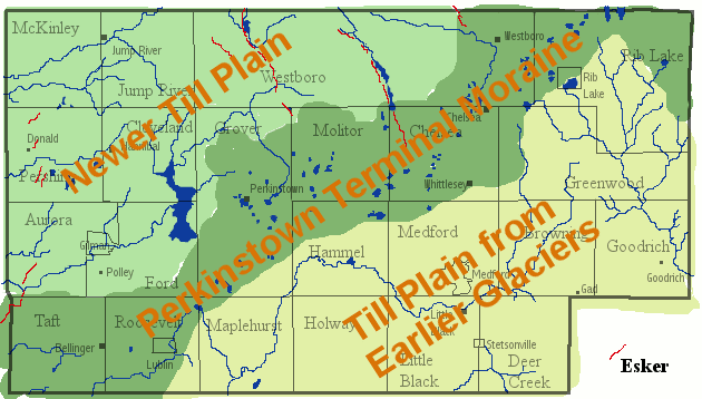
Image: Taylor County glacial map
No higher resolution available.
Taylor_County_glacial_map.gif (630 × 358 pixels, file size: 37 KB, MIME type: image/gif)
Description: A map showing the glacial landforms of Taylor County, Wisconsin. This is my broad-brush simplification of John Attig's "Pleistocene Geology of Taylor County, Wisconsin" at [1], which is public domain with attribution required.
Title: Taylor County glacial map
Credit: Own work
Author: Jeff the quiet
Usage Terms: Creative Commons Attribution 3.0
License: CC BY 3.0
License Link: http://creativecommons.org/licenses/by/3.0
Attribution Required?: Yes
Image usage
The following page links to this image:

All content from Kiddle encyclopedia articles (including the article images and facts) can be freely used under Attribution-ShareAlike license, unless stated otherwise.