
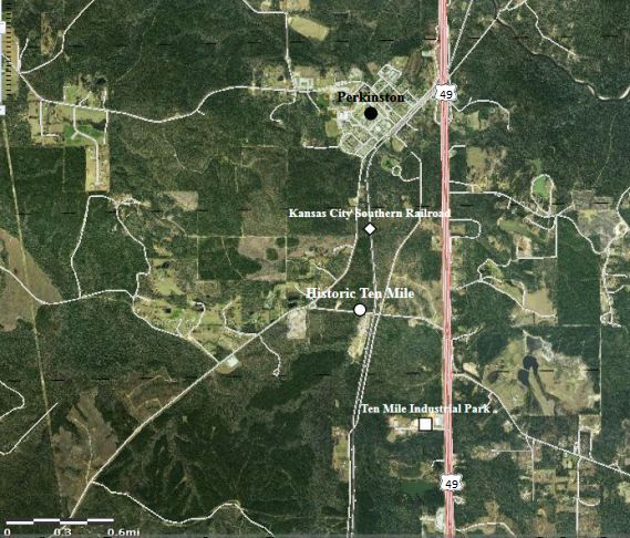
Image: Ten Mile, Mississippi aerial photo
No higher resolution available.
Ten_Mile,_Mississippi_aerial_photo.jpg (569 × 486 pixels, file size: 81 KB, MIME type: image/jpeg)
Description: Aerial view of Ten Mile community located in Stone County, Mississippi, USA.
Title: Ten Mile, Mississippi aerial photo
Credit: http://viewer.nationalmap.gov/viewer/
Author: USGS
Permission: Map services and data downloaded from The National Map are in the public domain. There are no restrictions, however USGS requests that the following acknowledgment statement of the originating agency be included in products and data derived from our map services when citing, copying, or reprinting: "Map services and data available from U.S. Geological Survey, National Geospatial Program".
Usage Terms: Public domain
License: Public domain
Attribution Required?: No
Image usage
The following page links to this image:

All content from Kiddle encyclopedia articles (including the article images and facts) can be freely used under Attribution-ShareAlike license, unless stated otherwise.