
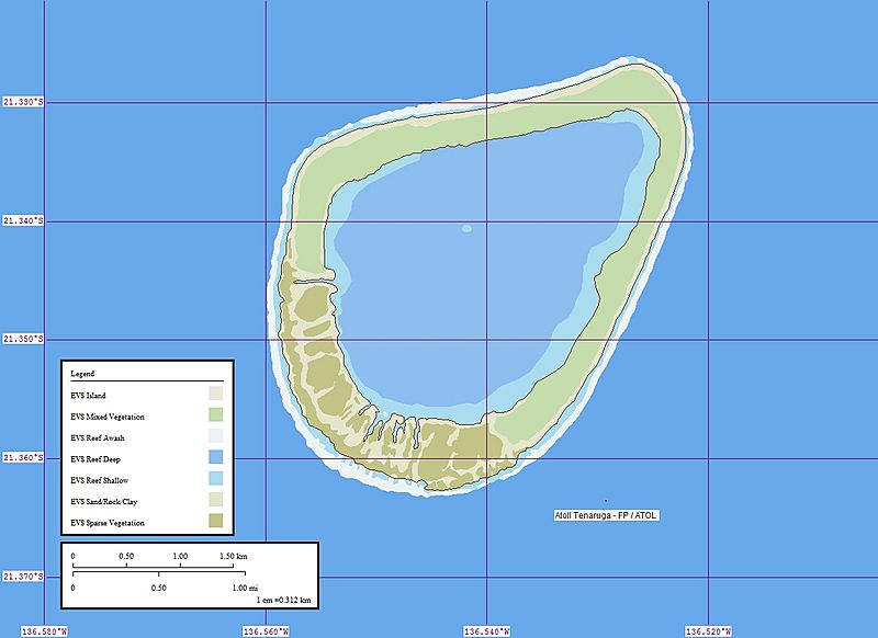
Image: Tenarunga Map

Size of this preview: 800 × 582 pixels. Other resolutions: 320 × 233 pixels | 1,240 × 902 pixels.
Original image (1,240 × 902 pixels, file size: 207 KB, MIME type: image/jpeg)
Description: EVS precision islands map of Tenarunga Atoll, Tuamotu Archipelago, French Polynesia
Title: Tenarunga Map
Credit: Own work, using Landsat S-08-20_2000, Global Mapper and Marplot.
Author: Peter Minton, California, (evsrequest@gmail.com)
Usage Terms: Public domain
License: Public domain
Attribution Required?: No
Image usage
The following page links to this image:

All content from Kiddle encyclopedia articles (including the article images and facts) can be freely used under Attribution-ShareAlike license, unless stated otherwise.