
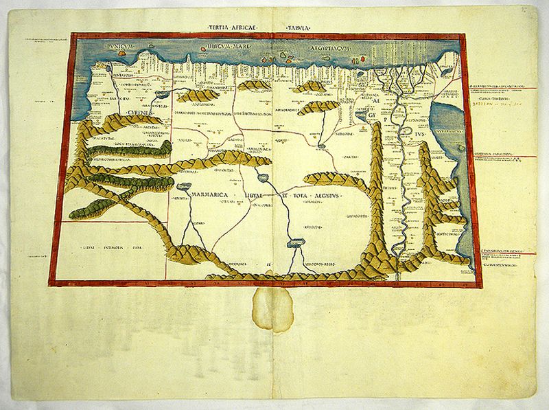
Image: Tertia Africae Tabula of 1478 after Ptolemy
Description: The Third African Map.Ptolemy described in his Geography (Latin: Geographia; Greek: Geographike Hyphegesis) the world how it was known in the 2nd century and pictured about 8000 locations with coordinates. His Geographia is the first try to illustrate parts of the spherical Earth. Even if Ptolemy`s maps from todays view are not really correct, is this map a reflection of the former view of the world. Due to the publishing date 1478 or 1490 this map is a product of the early modern printing. This map shows the Eastern part of North Africa with the Red Sea, Egypt with the course of the Nile, Libya and the Mediterranian Sea till the Sinai-Peninsula. Additionally to the the view certain coordinates with description are given and the former known course of rivers, mountains, islands and towns are represented.
Usage Terms: Public domain
Image usage
The following page links to this image:
