
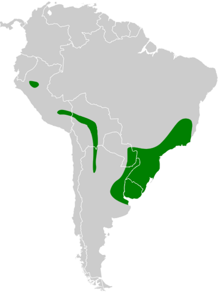
Image: Thamnophilus ruficapillus map 2

Description: Range map of rufous-capped antshrike (Thamnophilus ruficapillus)
Title: Thamnophilus ruficapillus map 2
Credit: Adapted from: BirdLife International. 2016. Thamnophilus ruficapillus. The IUCN Red List of Threatened Species 2016: e.T103657721A93825062. https://dx.doi.org/10.2305/IUCN.UK.2016-3.RLTS.T103657721A93825062.en. Downloaded on 02 May 2021. BirdLife International. 2017. Thamnophilus subfasciatus (amended version of 2016 assessment). The IUCN Red List of Threatened Species 2017: e.T103657725A112311576. https://dx.doi.org/10.2305/IUCN.UK.2017-1.RLTS.T103657725A112311576.en. Downloaded on 02 May 2021.
Author: Cephas
Usage Terms: Creative Commons Attribution-Share Alike 4.0
License: CC BY-SA 4.0
License Link: https://creativecommons.org/licenses/by-sa/4.0
Attribution Required?: Yes
Image usage
The following page links to this image:
