
Image: The British Empire Anachronous

Size of this preview: 800 × 407 pixels. Other resolutions: 320 × 163 pixels | 2,753 × 1,400 pixels.
Original image (2,753 × 1,400 pixels, file size: 457 KB, MIME type: image/png)
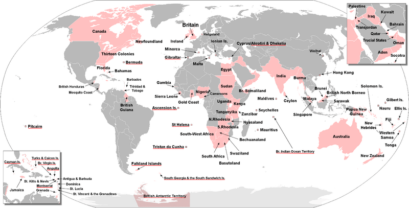
Description: Map of the world showing the extent of the British Empire in 1886. British territories coloured in red.
Title: The British Empire Anachronous
Credit: https://commons.wikimedia.org/wiki/Category:Old_maps_of_the_British_Empire#/media/File:British_empire_1886.jpg
Author: User:The_Red_Hat_of_Pat_Ferrick
Usage Terms: Creative Commons Attribution-Share Alike 4.0
License: CC BY-SA 4.0
License Link: http://creativecommons.org/licenses/by-sa/4.0
Attribution Required?: Yes
Image usage
There are no pages that link to this image.

All content from Kiddle encyclopedia articles (including the article images and facts) can be freely used under Attribution-ShareAlike license, unless stated otherwise.