
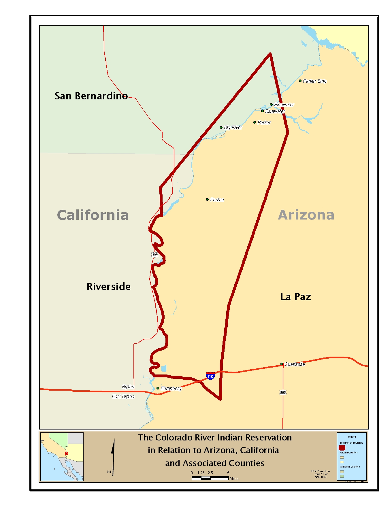
Image: The Colorado River Indian Reservation in Relation to Arizona, California and Associated Counties
Description: Location Map of the Colorado River's Indian (Indigenous peoples/Native American) Reservations' areas. Boundaries verified in comparison to figure 2 of [1]: "STATUS OF MINERAL RESOURCE INFORMATION FOR THE COLORADO RIVER INDIAN RESERVATION ARIZONA AND CALIFORNIA", Administrative Report BIA-50 1978, Jocelyn A. Peterson U.S. Geological Survey; L. G. Nonini U.S. Bureau of Mines, Prepared by U.S. Geological Survey and U.S. Bureau of Mines for U.S. Bureau of Indian Affairs. Road positions verified via [2] at Colorado River Indian Tribes website
Title: The Colorado River Indian Reservation in Relation to Arizona, California and Associated Counties
Credit: Own work
Author: Cenglish
Usage Terms: Creative Commons Zero, Public Domain Dedication
License: CC0
License Link: http://creativecommons.org/publicdomain/zero/1.0/deed.en
Attribution Required?: No
Image usage
The following 2 pages link to this image:
