
Image: The Devil's Staircase - geograph.org.uk - 1477999
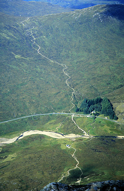
Description: The Devil's Staircase This view from Stob Dearg in Glen Coe shows the A82 road and the River Coupall, with the path on the north side of the road on the old military road (on the upper part of the photo) rising from Altnafeadh, known as the Devils Staircase. This is on the Kingshouse to Kinlochleven section of the West Highland Way. The building on the south side of the road is the Scottish Mountaineering Club hut at Lagangarbh. A path passes by this building with the left branch (from the photographers viewpoint) leading to Coire na Tulaich and the Munro baggers route to the Buachaille Etive Mor ridge. The right branch of the path provides quick access to climbing and scrambling routes on the north face of Stob Dearg, such as North Buttress and Curved Ridge.
Title: The Devil's Staircase - geograph.org.uk - 1477999
Credit: From geograph.org.uk
Author: Walter Baxter
Usage Terms: Creative Commons Attribution-Share Alike 2.0
License: CC BY-SA 2.0
License Link: https://creativecommons.org/licenses/by-sa/2.0
Attribution Required?: Yes
Image usage
The following page links to this image:
