
Image: The Grey Ditch - geograph.org.uk - 177318
Size of this preview: 800 × 600 pixels. Other resolutions: 320 × 240 pixels | 1,280 × 960 pixels.
Original image (1,280 × 960 pixels, file size: 311 KB, MIME type: image/jpeg)
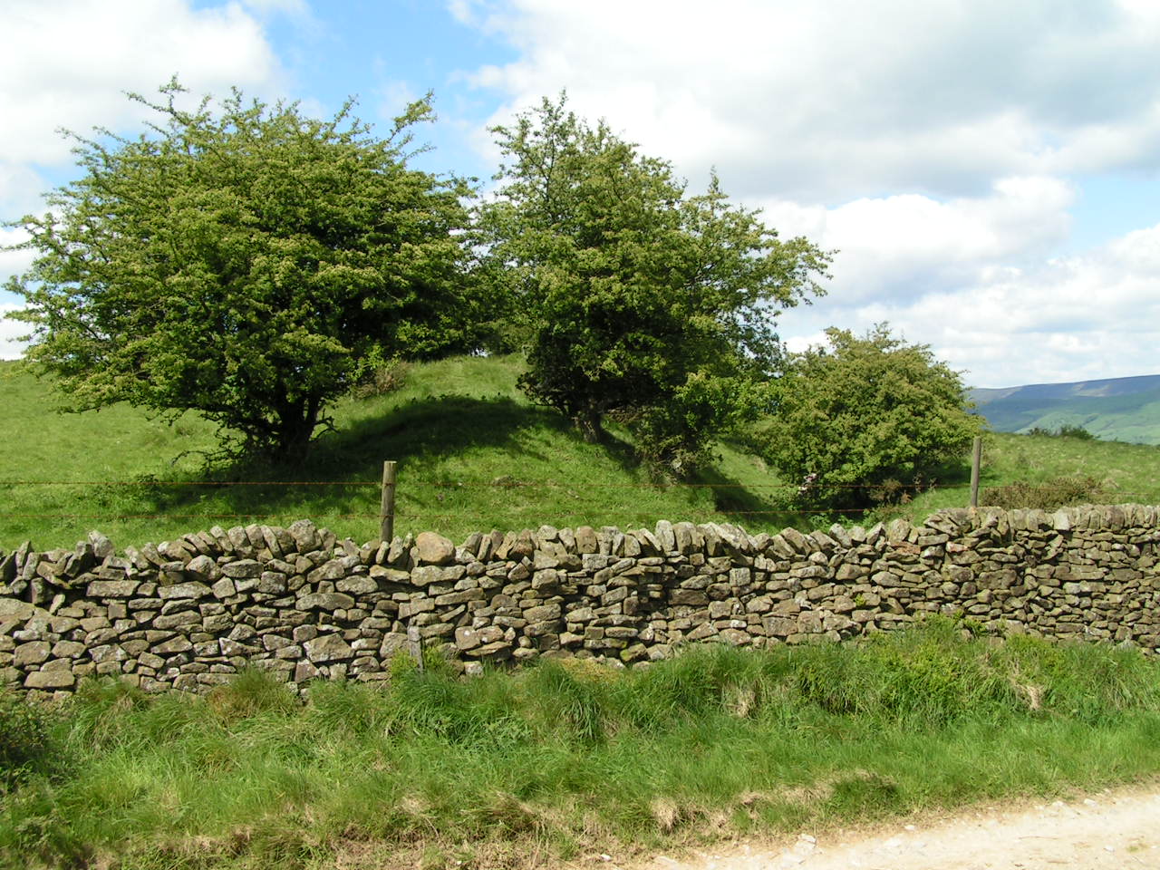
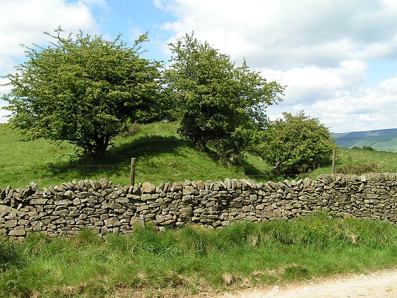
Description: The Grey Ditch. Thought to be an early medieval boundary marker (one of only three in the Peak District), the section of the Grey Ditch adjoining Brough Lane on Rebellion Knoll is the best preserved. See http://www.magic.gov.uk/rsm/29813.pdf for more information. Wikidata has entry Q17674270 with data related to this item.
Title: The Grey Ditch - geograph.org.uk - 177318
Credit: Own work
Author: Dave Dunford
Usage Terms: Creative Commons Attribution-Share Alike 2.0
License: CC BY-SA 2.0
License Link: https://creativecommons.org/licenses/by-sa/2.0
Attribution Required?: Yes
Image usage
The following page links to this image:

All content from Kiddle encyclopedia articles (including the article images and facts) can be freely used under Attribution-ShareAlike license, unless stated otherwise.