
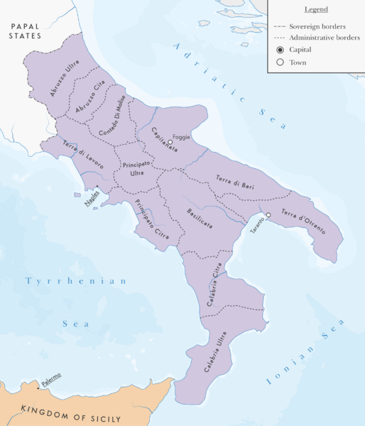
Image: The Kingdom of naples with administrative divisions as they were in 1454

Description: Centred on 40°30"N 15°45"E, with the Albers Equal Area Conic projection with a central meridian at 15°45"E. The scale is 1 to 3 000 000. The location of all cities was sourced from the 1968 English translation of the Atlas Świata by the Polish Army Topographical Service, originally published in 1962. The fact that they existed in and around the 13th century was sourced from their individual Encyclopædia Britannica online pages. The administrative boundaries of the Kingdom of Naples were sourced from this map https://commons.wikimedia.org/wiki/File:Province_napoletane_(1454).PNG#mw-jump-to-license.
Title: The Kingdom of naples with administrative divisions as they were in 1454
Credit: Own work
Author: Cattette
Usage Terms: Creative Commons Attribution-Share Alike 4.0
License: CC BY-SA 4.0
License Link: https://creativecommons.org/licenses/by-sa/4.0
Attribution Required?: Yes
Image usage
The following page links to this image:
