
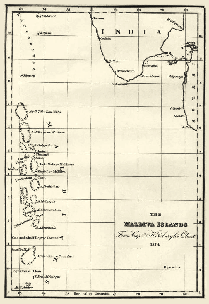
Image: The Maldiva Islands-Captain Horsburgh-1814
Size of this preview: 411 × 599 pixels. Other resolutions: 165 × 240 pixels | 714 × 1,040 pixels.
Original image (714 × 1,040 pixels, file size: 323 KB, MIME type: image/png)
Description: 1814 map of 'The Maldiva Islands' by Captain James Horsburgh
Title: The Maldiva Islands-Captain Horsburgh-1814
Credit: Directions for Sailing to and from the East Indies, China, New Holland, Cape of Good Hope, and the interjacent Ports, compiled chiefly from original Journals and Observations made during 21 years' experience in navigating those Seas
Author: James Horsburgh (1762 – 1836)
Usage Terms: Public domain
License: Public domain
Attribution Required?: No
Image usage
The following page links to this image:

All content from Kiddle encyclopedia articles (including the article images and facts) can be freely used under Attribution-ShareAlike license, unless stated otherwise.