
Image: The Roman Empire ca 400 AD
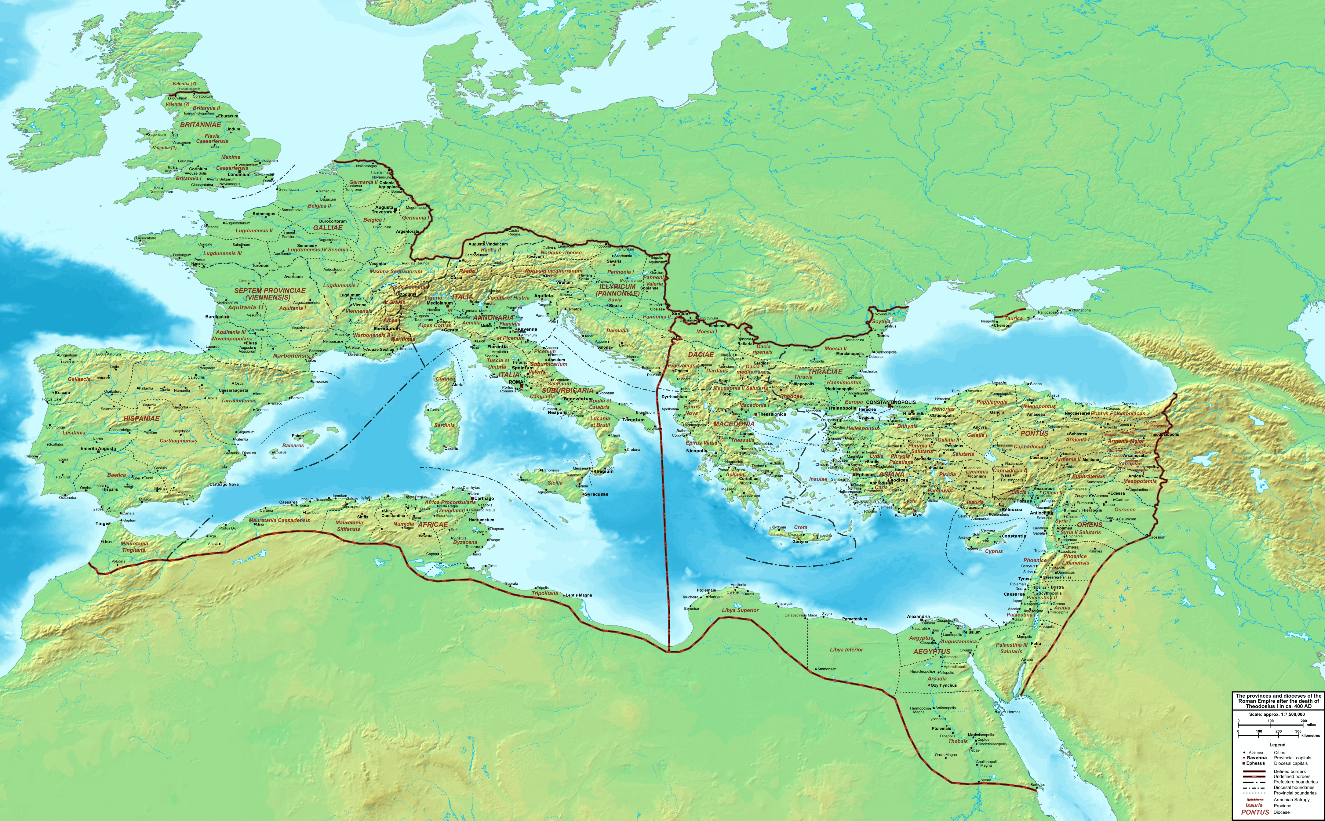
Description: Map of the Roman Empire ca. 400 AD, showing the administrative division into dioceses and provinces, as well as the major cities. The demarcation between Eastern and Western Empires is noted in red.
Title: The Roman Empire ca 400 AD
Credit: Base map found at User:Koba-chan/Topographic map, otherwise self-made. Data based on maps in atlases (Westermann's Atlas zur Weltgeschichte, the Academy of Athens' History of the Greek Nation, etc.) and the internet and on contemporary sources, primarily the Notitia Dignitatum and the Synecdemus. Note: the exact course of the provincial boundaries is often uncertain, and in the case of Britain, entirely unknown. Therefore, provincial boundaries are in many cases only approximate, based on the best available information. Any help and corrections are welcome.
Author: Cplakidas
Usage Terms: Public domain
License: Public domain
Attribution Required?: No
Image usage
The following page links to this image:
