
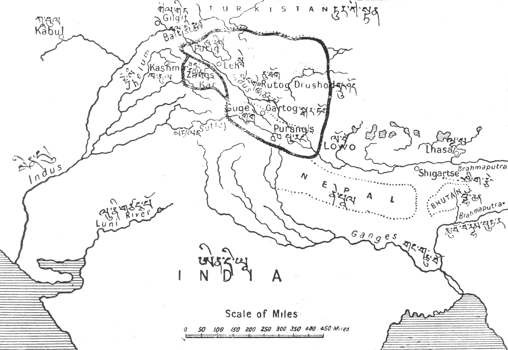
Image: The Territorial Extent of Ladakh during the period of King Nyimagon about 975 A. D.- 1000 A.D. as depicted in A History of Western Tibet by A.H. Francke, 1907
Description: The Territorial Extent of Ladakh during the period of King Nyimagon about 975 A. D.- 1000 A.D. as depicted in A History of Western Tibet by A.H. Francke, 1907 depicting not just the Aksai Chin but also inter alia Rudokh and Guge and the area to the west of the ridges which separate the plateau of Tibet from the highlands of Kashmir wherein are the Aling Kangri and Mavang Kangri peaks, to the south of the Pulu Pass at the point where the Kuen Lun Range in Kashmir which runs southeast to northwest and the Altyn Tagh range in Tibet running southwest to northeast, converge forming a "V" shape and culminating near the vicinity of Mayum La, as integral part of Ladakh.
Title: The Territorial Extent of Ladakh during the period of King Nyimagon about 975 A. D.- 1000 A.D. as depicted in A History of Western Tibet by A.H. Francke, 1907
Credit: A History of Western Tibet by A.H. Francke, 1907
Author: August Hermann Francke (1870-1930)
Usage Terms: Public domain
License: Public domain
Attribution Required?: No
Image usage
The following image is a duplicate of this image (more details):
There are no pages that link to this image.
