
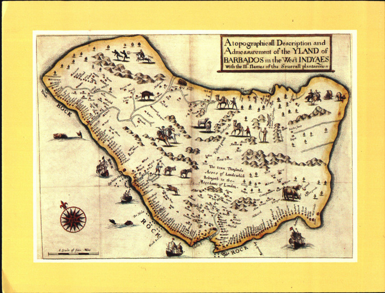
Image: The earliest printed map of Barbados by Richard Ligon, 1657, KITLV 1407468f
Size of this JPG preview of this TIF file: 786 × 599 pixels. Other resolution: 315 × 240 pixels.
Original image (2,433 × 1,855 pixels, file size: 13.06 MB, MIME type: image/tiff)
Description: Title: \"The earliest printed map of Barbados by Richard Ligon, 1657\" Shelfmark: KITLV 1407468 Subject (topical): Maps Subject (geographic): Barbados Language: No linguistic content Country: No place, unknown, or undetermined Published: [Between the 19th and 20th century] Persistent URL: http://hdl.handle.net/1887.1/item:863092 Extent: Digital image
Title: The earliest printed map of Barbados by Richard Ligon, 1657, KITLV 1407468
Credit: http://hdl.handle.net/1887.1/item:863092
Author: AnonymousUnknown author
Usage Terms: Creative Commons Attribution 4.0
License: CC BY 4.0
License Link: https://creativecommons.org/licenses/by/4.0
Attribution Required?: Yes
Image usage
The following page links to this image:

All content from Kiddle encyclopedia articles (including the article images and facts) can be freely used under Attribution-ShareAlike license, unless stated otherwise.