
Image: Thermopylae map 480bc
No higher resolution available.
Thermopylae_map_480bc.png (542 × 417 pixels, file size: 24 KB, MIME type: image/png)
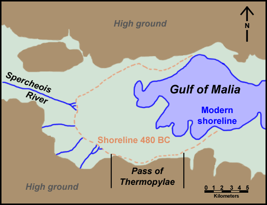
Description: Map of Thermopylae area with modern shoreline and reconstructed shoreline of 480 BC. Loosely based on figure 3.19 in Geoarchaeology: The Earth-science Approach to Archaeological Interpretation, p. 96. George Robert Rapp, Christopher L. Hill. Yale University Press, 2006. ISBN 0300109660
Title: Thermopylae map 480bc
Credit: Own work
Author: ChrisO
Permission: Public domain
Usage Terms: Public domain
License: Public domain
Attribution Required?: No
Image usage
There are no pages that link to this image.

All content from Kiddle encyclopedia articles (including the article images and facts) can be freely used under Attribution-ShareAlike license, unless stated otherwise.