
Image: Thornapple TIGER Irving dam area map3c

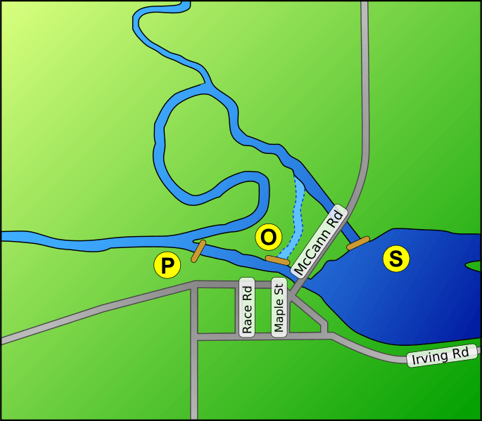
Description: A map of the area of the Irving Dam in Irving, Michigan on the Thornapple River. The Irving dam is actually three different structures, which are labeled on the map as follows: P - The powerhouse O - The old flow control structure S - the new flow control structure
Title: Thornapple TIGER Irving dam area map3c
Credit: This map is modified from a USGS/USCB TIGER generated map - link to original map This TerraServer-USA topographical map shows the area clearly as well. Google maps are lacking in detail in this area.
Author: Original PNG version (Image:Thornapple_TIGER_Irving_dam_area_map3c.PNG) generated by User:Lar (w:en:User:Lar) using the US Government provided TIGER tool. This map was then redrawn as an SVG by Amada44 and reuploaded.
Permission: PD US Government - TIGER is a service of the United States Census Bureau, and therefore the base image, like all TIGER images, is in the public domain. This derived image is Dual licensed under GFDL and Creative Commons Attribution 2.5 (CC-BY 2.5)
Usage Terms: Creative Commons Attribution 2.5
License: CC BY 2.5
License Link: http://creativecommons.org/licenses/by/2.5
Attribution Required?: Yes
Image usage
The following page links to this image:
