
Image: Thorne Canals map
No higher resolution available.
Thorne_Canals_map.jpg (569 × 400 pixels, file size: 31 KB, MIME type: image/jpeg)
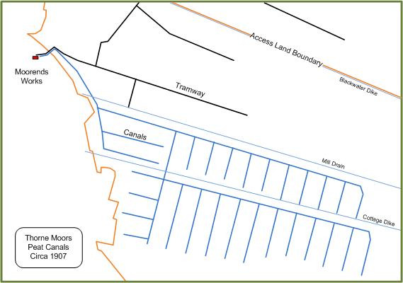
Description: Map of the peat canals on Thorne Moors circa 1907, based on Ordnance Survey 1:10,560 map (1907)
Title: Thorne Canals map
Credit: Own work
Author: Bob1960evens
Usage Terms: Creative Commons Attribution-Share Alike 3.0
License: CC BY-SA 3.0
License Link: https://creativecommons.org/licenses/by-sa/3.0
Attribution Required?: Yes
Image usage
The following page links to this image:

All content from Kiddle encyclopedia articles (including the article images and facts) can be freely used under Attribution-ShareAlike license, unless stated otherwise.