
Image: Topographical Map of Traditional Galloway

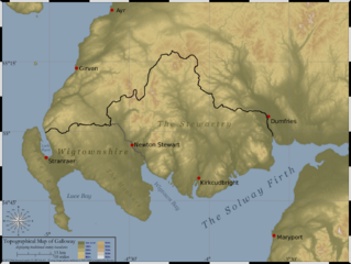
Description: Created by myself, Topographical Map of the area of SW Scotland traditionally defined as Galloway (the counties of Wigtownshire and The Stewartry). Topographical data derived from NASA SRTM, public domain. County boundaries derived from 1821 map of southern Scotland by John Ainslie of Macreadie Skelly & Co, presumed PD by Berne Convention. Compass rose by Stefan-Xp
Title: Topographical Map of Traditional Galloway
Credit: No machine-readable source provided. Own work assumed (based on copyright claims).
Author: No machine-readable author provided. SFC9394 assumed (based on copyright claims).
Usage Terms: Creative Commons Attribution 2.5
License: CC BY 2.5
License Link: https://creativecommons.org/licenses/by/2.5
Attribution Required?: Yes
Image usage
The following page links to this image:
