
Image: Tracking Drought (20463287863)
Size of this preview: 800 × 572 pixels. Other resolutions: 320 × 229 pixels | 2,570 × 1,836 pixels.
Original image (2,570 × 1,836 pixels, file size: 5.53 MB, MIME type: image/jpeg)
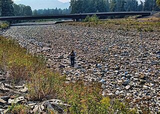
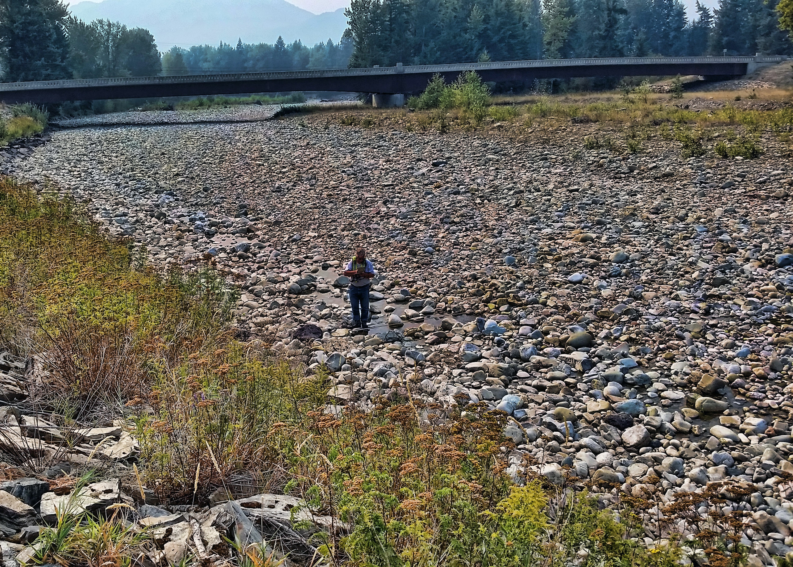
Description: Tracking Drought — A hydrologic technician from the USGS Idaho Water Science Center measures streamflow in Lightning Creek at Clark Fork, ID. The USGS is collecting data at hundreds of sites on rivers and streams in six western states to document the 2015 drought. USGS scientists will analyze the data to identify which rivers and streams may be most vulnerable to future droughts. Learn more at id.water.usgs.gov/
Title: Tracking Drought (20463287863)
Credit: Tracking Drought
Author: U.S. Geological Survey from Reston, VA, USA
Usage Terms: Public domain
License: Public domain
Attribution Required?: No
Image usage
The following page links to this image:

All content from Kiddle encyclopedia articles (including the article images and facts) can be freely used under Attribution-ShareAlike license, unless stated otherwise.
.jpg)