
Image: TreatyOfSevres

Size of this preview: 800 × 577 pixels. Other resolutions: 320 × 231 pixels | 1,024 × 738 pixels.
Original image (1,024 × 738 pixels, file size: 42 KB, MIME type: image/png)
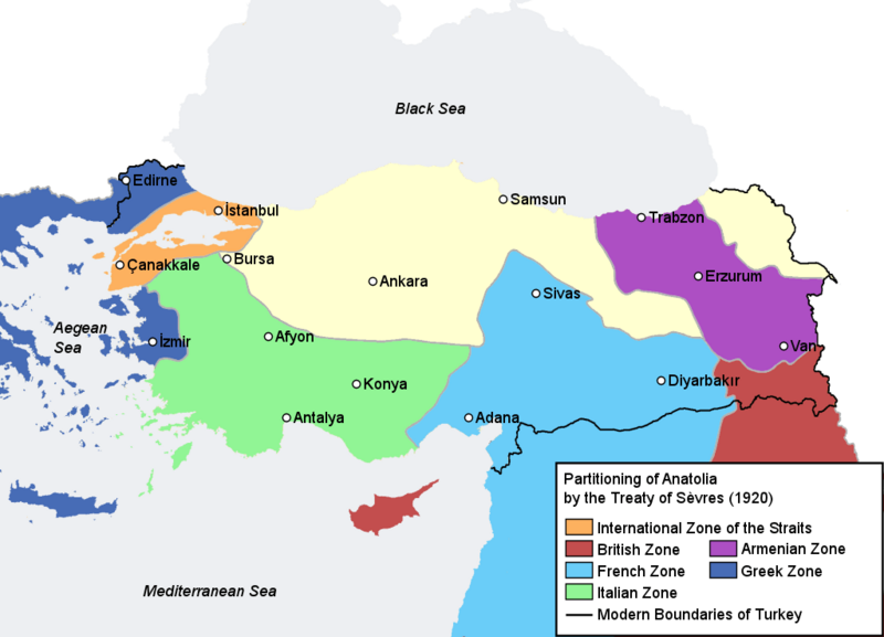
Description: Map illustrating the partitioning of Anatolia according to the Treaty of Sèvres (1920) after World War I.
Title: TreatyOfSevres
Credit: Self-made, based on Image:Turkey map blank.png and with information compiled from [1], [2]
Author: AtilimGunesBaydin
Permission: Public domainPublic domainfalsefalse I, the copyright holder of this work, release this work into the public domain. This applies worldwide. In some countries this may not be legally possible; if so: I grant anyone the right to use this work for any purpose, without any conditions, unless such conditions are required by law.
Usage Terms: Public domain
License: Public domain
Attribution Required?: No
Image usage
The following page links to this image:

All content from Kiddle encyclopedia articles (including the article images and facts) can be freely used under Attribution-ShareAlike license, unless stated otherwise.