
Image: TroisRivieres1759
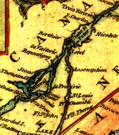
Description: This is a detail from the source map, which is entitled: A new chart of the River St. Lawrence from the Island of Anticosti to Lake Ontario This detail shows the lower Richelieu River valley and the Saint Lawrence River valley between Montreal and Trois-Rivières, including many locations relevant to the 1776 Battle of Trois-Rivières.
Title: TroisRivieres1759
Credit: From the Library and Archive of Quebec (http://www.banq.qc.ca/). URL at time of upload: http://catalogue.banq.qc.ca/cgi-bin/bestn?id=%5FZjow%2F%E2%7Dt%2DJQNFwwdX&act=15&rec=3&auto=0&nov=1&t0=Ontario&i0=0&s0=5&mdc=1&dac=1&v0=0&v1=0&v2=0&v3=0&v4=0&md=200&sy=1757&ey=1770&scr=1&media=1&line=2 Call number: G 3312 S5 1759 K5 CAR
Author: Thomas Kitchin
Usage Terms: Public domain
License: Public domain
Attribution Required?: No
Image usage
The following 2 pages link to this image:
