
Image: Tropical Storm Hanna (2002)
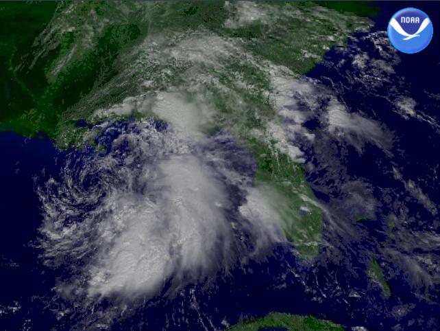
Description: The National Weather Service's Tropical Prediction Center shows Tropical Storm Hanna 105 miles south-southwest of the mouth of the Mississippi River. Winds are sustained at 45 MPH with stronger gusts.
Title: Tropical Storm Hanna (2002)
Credit: http://www.nnvl.noaa.gov/cgi-bin/index.cgi?page=items&ser=104823
Author: NOAA / Satellite and Information Service
Permission: This image is in the public domain because it contains materials that originally came from the U.S. National Oceanic and Atmospheric Administration, taken or made as part of an employee's official duties. Čeština | Deutsch | Zazaki | English | Español | Eesti | Suomi | Français | Magyar | Italiano | 日本語 | 한국어 | Македонски | മലയാളം | Plattdüütsch | Nederlands | Polski | Português | Română | Русский | Sicilianu | Slovenščina | Türkçe | 中文 | 中文(简体) | +/− The NOAA emblem is the property of the U.S. Government and a trademark of the United States Department of Commerce.
Usage Terms: Public domain
License: Public domain
Attribution Required?: No
Image usage
The following page links to this image:

.jpg)