
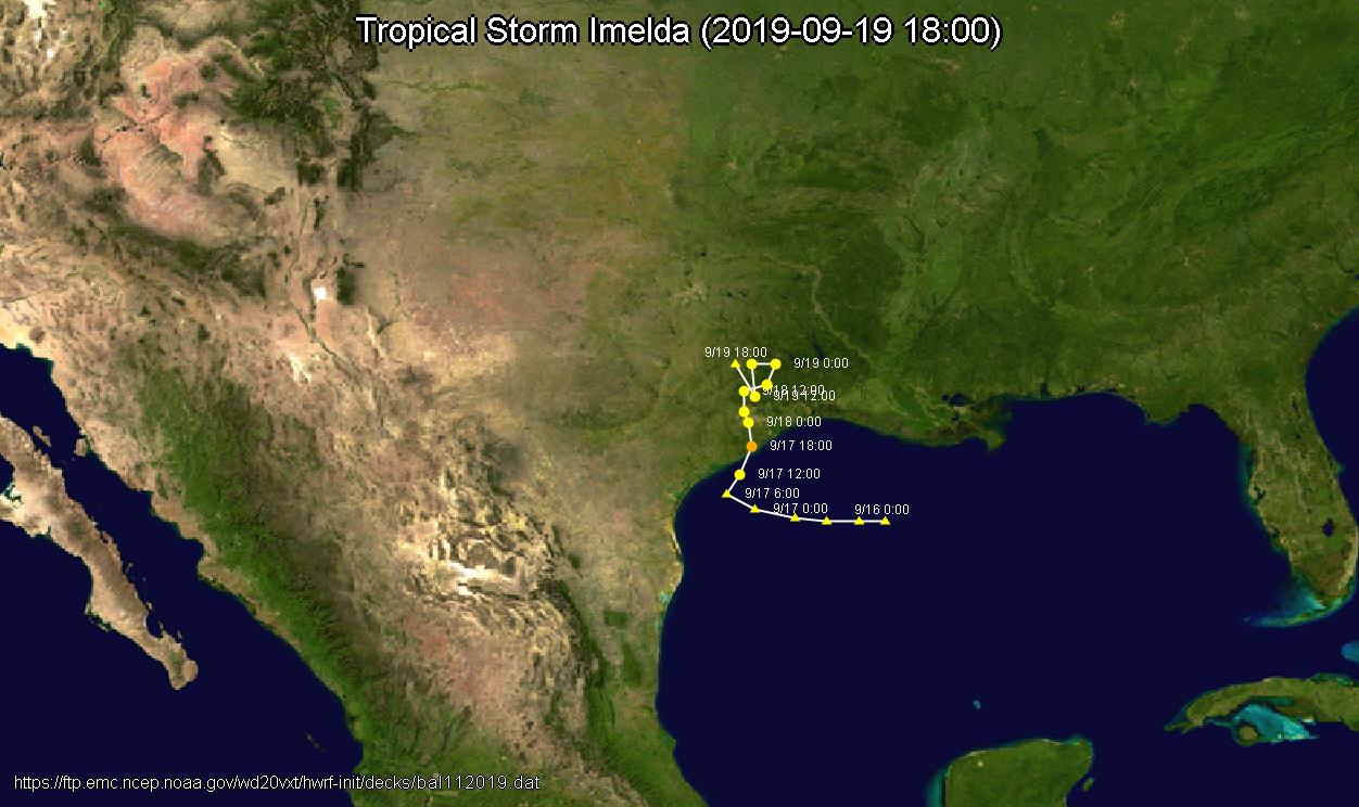
Image: Tropical Storm Imelda map 2019-09-19 1800
Size of this preview: 800 × 475 pixels. Other resolutions: 320 × 190 pixels | 1,252 × 744 pixels.
Original image (1,252 × 744 pixels, file size: 138 KB, MIME type: image/jpeg)
Description: Tropical Storm Imelda map 2019-09-19 1800 Saffir–Simpson scale ➎: Category 5; ➍: Category 4; ➌: Category 3; ➋: Category 2; ➊: Category 1; : Tropical storm; : Tropical depression Storm type : Tropical cyclone; : Subtropical cyclone; : Extratropical cyclone / Remnant low / Tropical disturbance / Monsoon depression
Title: Tropical Storm Imelda map 2019-09-19 1800
Credit: Own work Data source: bal112019.dat, NOAA Background image: File:Whole world - land and oceans.jpg
Author: Phoenix7777
Usage Terms: Creative Commons Attribution-Share Alike 4.0
License: CC BY-SA 4.0
License Link: https://creativecommons.org/licenses/by-sa/4.0
Attribution Required?: Yes
Image usage
The following page links to this image:

All content from Kiddle encyclopedia articles (including the article images and facts) can be freely used under Attribution-ShareAlike license, unless stated otherwise.