
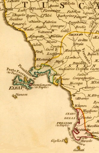
Image: Tuscany, Piombino, Elba, State of the Presidios, 1800
No higher resolution available.
Tuscany,_Piombino,_Elba,_State_of_the_Presidios,_1800.jpg (329 × 508 pixels, file size: 89 KB, MIME type: image/jpeg)
Description: Section of a map from 1800 showing the Principality of Piombino and the State of the Presidi, which belonged to the Kingdom of Naples. Control over the mineral-rich island of Elba was divided between Tuscany, Piombino and the State of the Presidi (Porto Longone). Map of the Grand Duchy of Tuscany and the Papal States published by British mapmaker Robert Wilkinson in 1800.
Title: Tuscany, Piombino, Elba, State of the Presidios, 1800
Credit: Antique maps online
Author: Robert Wilkinson, London, 1800.
Usage Terms: Public domain
License: Public domain
Attribution Required?: No
Image usage
The following page links to this image:

All content from Kiddle encyclopedia articles (including the article images and facts) can be freely used under Attribution-ShareAlike license, unless stated otherwise.