
Image: TyreMap1764 JacquesNicolasBellin LePetitAtlasMaritime III-17-b
Size of this preview: 481 × 600 pixels. Other resolutions: 192 × 240 pixels | 2,765 × 3,448 pixels.
Original image (2,765 × 3,448 pixels, file size: 5.01 MB, MIME type: image/jpeg)
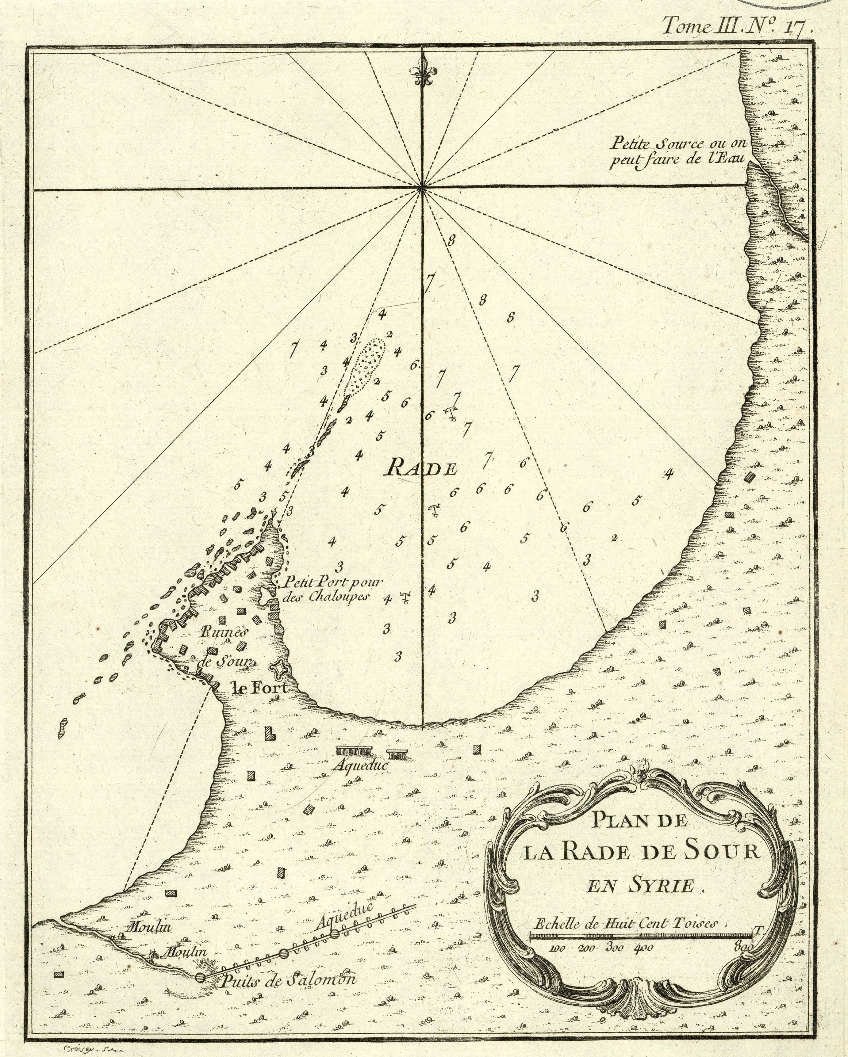
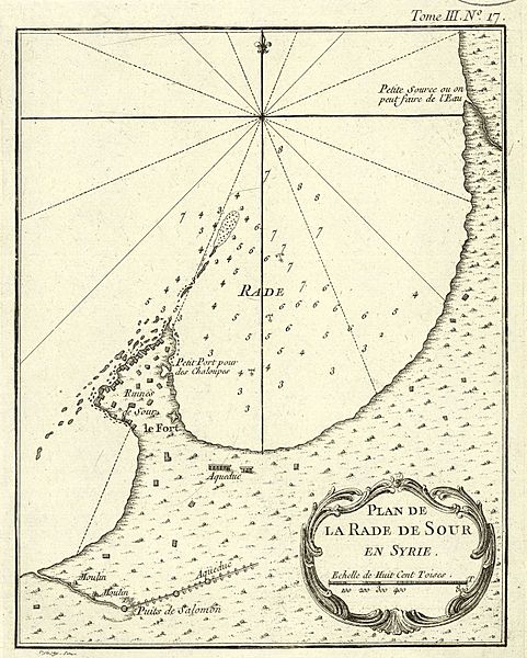
Description: Map of the peninsula of Tyre/Sour in what is now Southern Lebanon, published in 1764 in Paris, drawn by French hydrographer and geographer Jacques Nicolas BELLIN
Title: TyreMap1764 JacquesNicolasBellin LePetitAtlasMaritime III-17-b
Credit: "Le Petit Atlas maritime recueil de cartes et plans des quatre parties du Monde", Paris 1764
Author: Jacques Nicolas BELLIN (1703 – 21 March 1772)
Usage Terms: Public domain
License: Public domain
Attribution Required?: No
Image usage
The following page links to this image:

All content from Kiddle encyclopedia articles (including the article images and facts) can be freely used under Attribution-ShareAlike license, unless stated otherwise.