
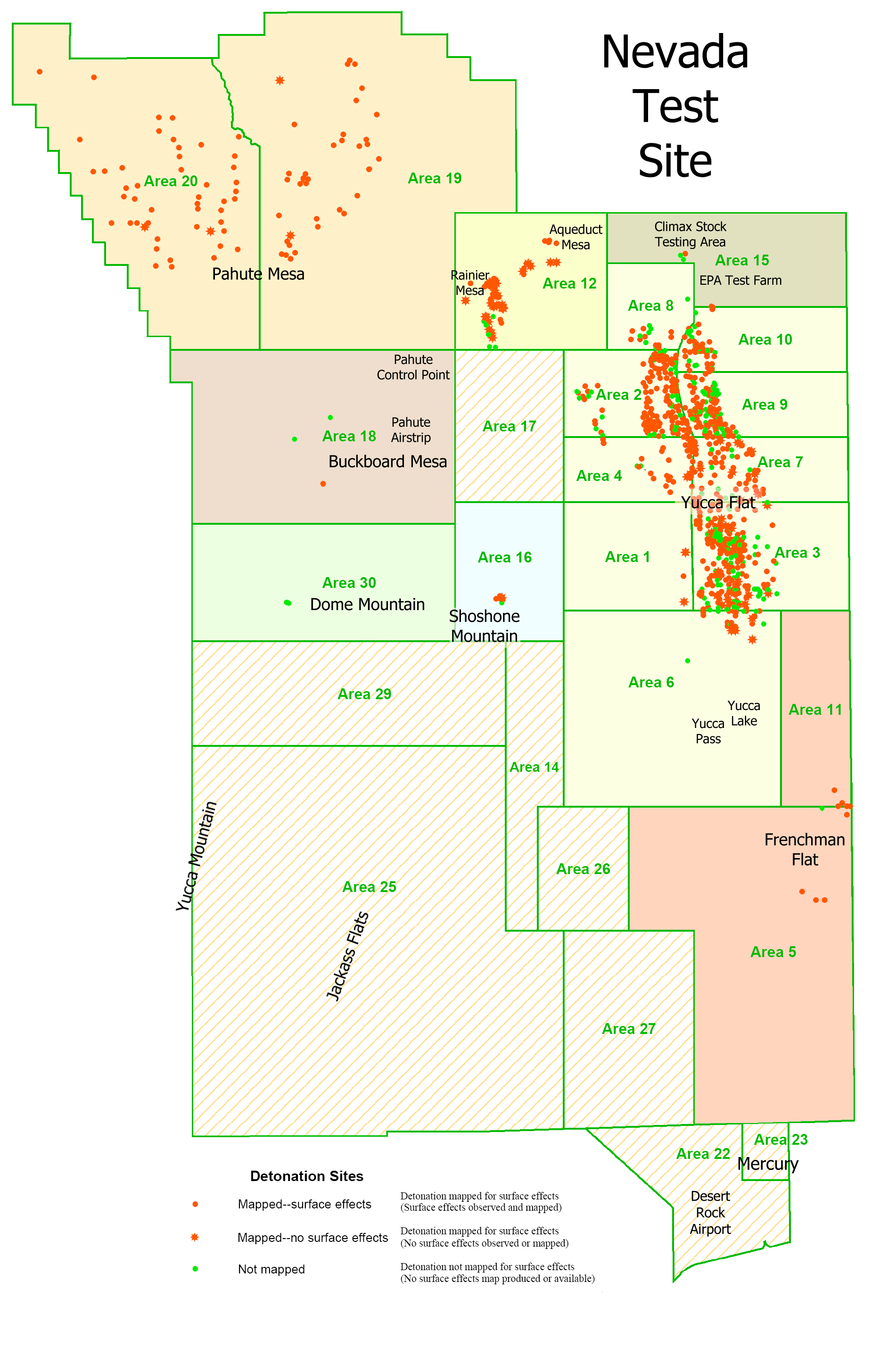
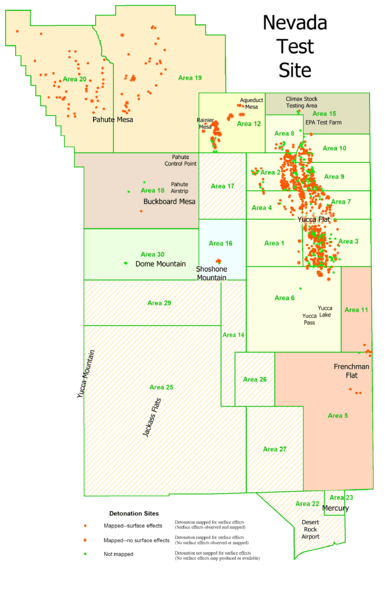
Image: USGS NTS detonations
Size of this preview: 388 × 599 pixels. Other resolutions: 155 × 240 pixels | 1,884 × 2,910 pixels.
Original image (1,884 × 2,910 pixels, file size: 339 KB, MIME type: image/png)
Description: This is a derivative work. It is my retooling of a USGS map called "Geologic Surface Effects of Underground Nuclear Testing, Buckboard Mesa, Climax Stock, Dome Mountain, Frenchman Flat, Rainier/Aqueduct Mesa, and Shoshone Mountain, Nevada Test Site, Nevada."
Title: USGS NTS detonations
Credit: http://pubs.usgs.gov/of/2003/ofr-03-125/
Author: Dennis N. Grasso, USGS
Permission: public domain
Usage Terms: Public domain
License: Public domain
Attribution Required?: No
Image usage
The following 3 pages link to this image:

All content from Kiddle encyclopedia articles (including the article images and facts) can be freely used under Attribution-ShareAlike license, unless stated otherwise.