
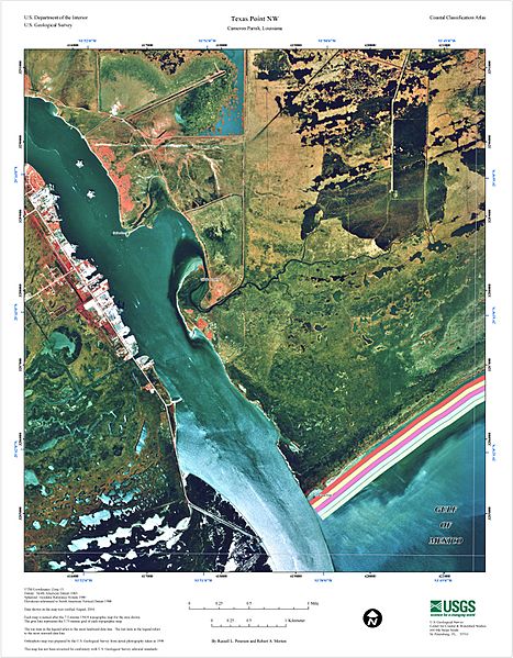
Image: USGS map of Sabine Pass

Size of this preview: 467 × 599 pixels. Other resolutions: 187 × 240 pixels | 1,500 × 1,924 pixels.
Original image (1,500 × 1,924 pixels, file size: 900 KB, MIME type: image/jpeg)
Description: USGS map of Sabine Pass at the border of Texas and Louisiana, 2004. Orthophoto map was prepared by the U.S. Geological Survey from aerial photography taken in 1998
Title: USGS map of Sabine Pass
Credit: https://pubs.usgs.gov/of/2005/1261/texas-pointNW.html
Author: USGS
Usage Terms: Public domain
License: Public domain
Attribution Required?: No
Image usage
The following page links to this image:

All content from Kiddle encyclopedia articles (including the article images and facts) can be freely used under Attribution-ShareAlike license, unless stated otherwise.