
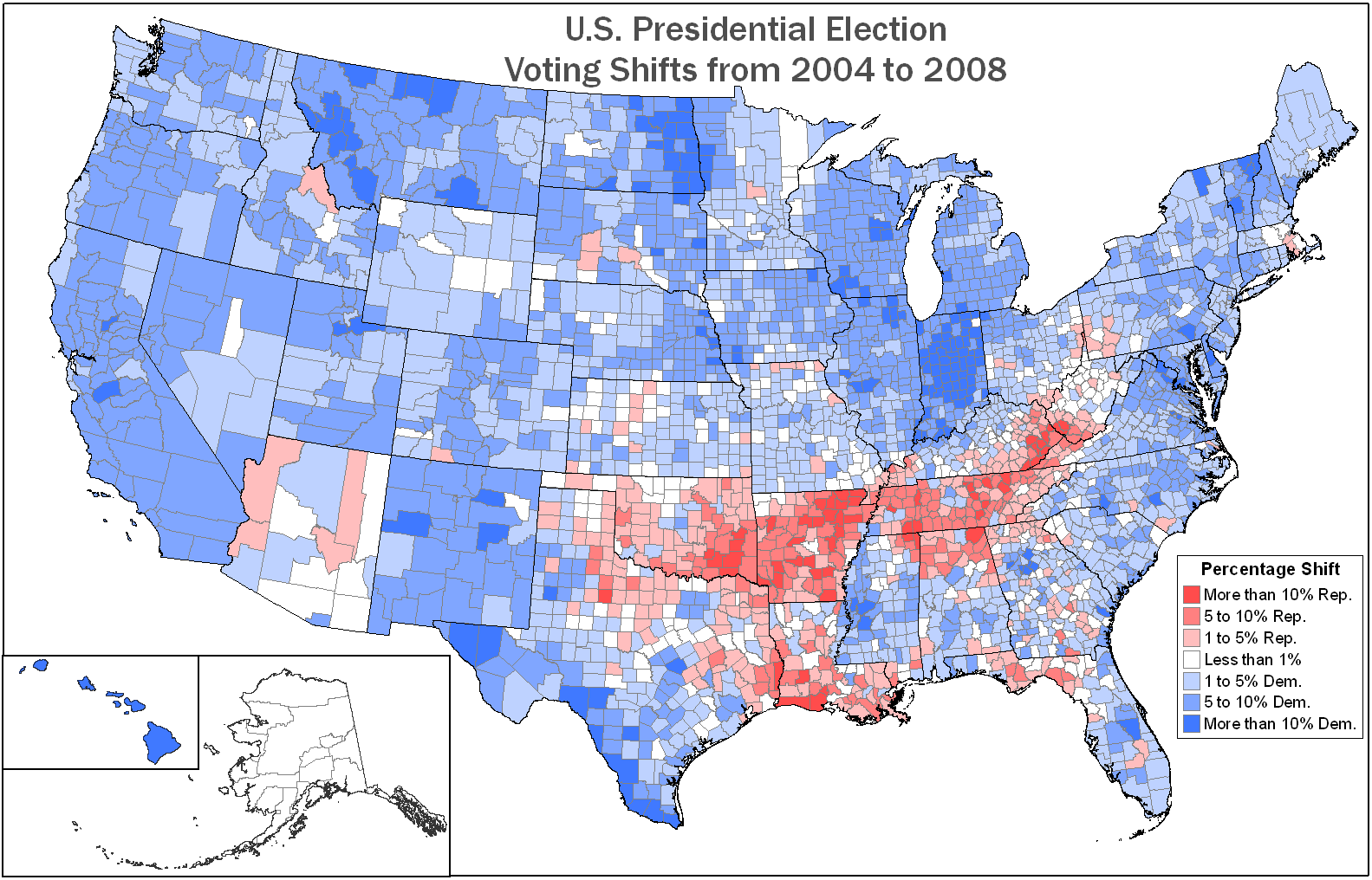
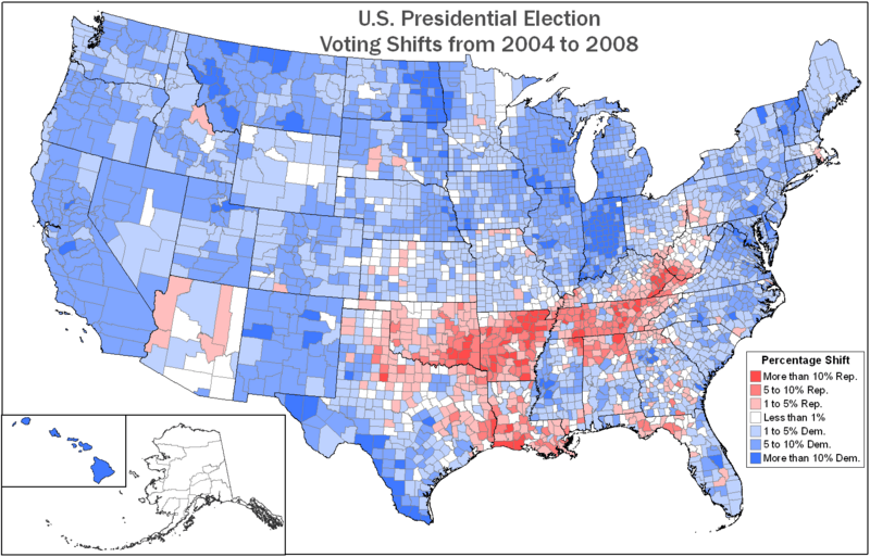
Image: US Election04-08shift
Size of this preview: 800 × 513 pixels. Other resolutions: 320 × 205 pixels | 1,583 × 1,016 pixels.
Original image (1,583 × 1,016 pixels, file size: 84 KB, MIME type: image/png)
Description: This map shows the shift in voting patterns from the 2004 U.S. presidential election and the 2008 U.S. presidential election.
Title: US Election04-08shift
Credit: Map is self-created. State and county boundaries from the National Atlas. Voting results are as reported by USA Today and compiled by Mark Newman, Department of Physics and Center for the Study of Complex Systems, University of Michigan. Alaska is based on state-wide rather than county data.
Author: Kmusser (talk)
Usage Terms: Creative Commons Attribution-Share Alike 3.0
License: CC BY-SA 3.0
License Link: http://creativecommons.org/licenses/by-sa/3.0
Attribution Required?: Yes
Image usage
The following page links to this image:

All content from Kiddle encyclopedia articles (including the article images and facts) can be freely used under Attribution-ShareAlike license, unless stated otherwise.