
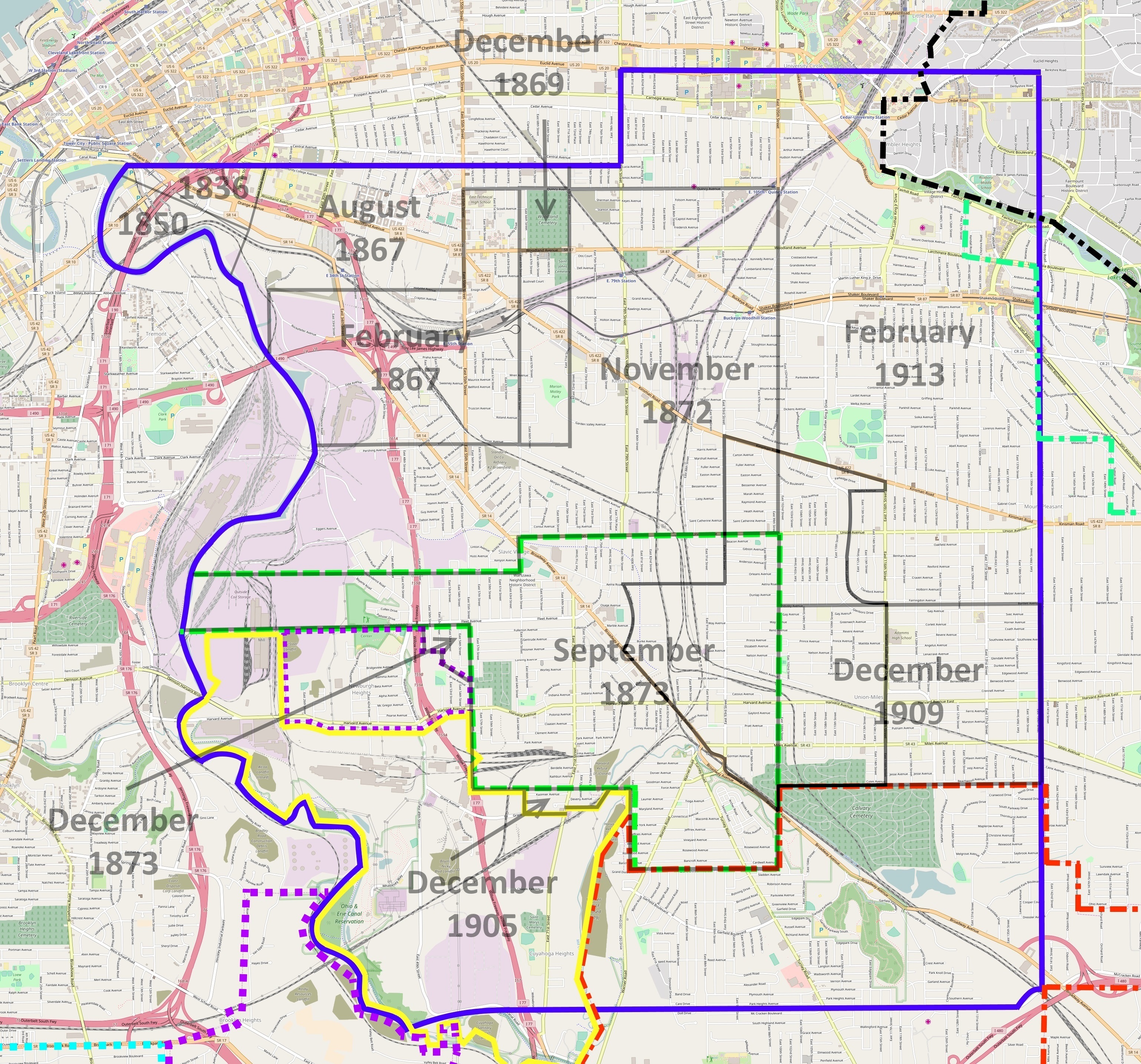
Image: Union-Miles Park annexation overlap
Description: Map of the original 1814 Newburg Township, with the Union-Miles Park neighborhood in solid black. Showing annexations by the city of Cleveland, and incorporations by Newburgh Heights, Cuyahoga Heights, Cleveland Heights, Shaker Heights, and Garfield Heights. Map based on information contained in Orth, Samuel P. (1910). A History of Cleveland, Ohio. Volume 1. Chicago: S.J. Clarke Publishing, page 46 overleaf; Chapman, Edmund H. (1981). Cleveland: Village to Metropolis. Cleveland: Western Reserve Historical Society. ISBN 0911704299. pages 20-21; Vail, H.L.; Snyder, L.M. (1890). Ordinances of the City of Cleveland. Revised and Consolidated. Cleveland: Clark-Britton Printing Co. pages 455-465.
Title: Union-Miles Park annexation overlap
Credit: Own work
Author: Tim1965
Usage Terms: Creative Commons Attribution-Share Alike 4.0
License: CC BY-SA 4.0
License Link: https://creativecommons.org/licenses/by-sa/4.0
Attribution Required?: Yes
Image usage
The following page links to this image:
