
Image: Unknown & Hughes A New Map of Mexico, California & Oregon 1846-1848 UTA
Size of this preview: 434 × 599 pixels. Other resolutions: 174 × 240 pixels | 2,167 × 2,990 pixels.
Original image (2,167 × 2,990 pixels, file size: 1.98 MB, MIME type: image/jpeg)
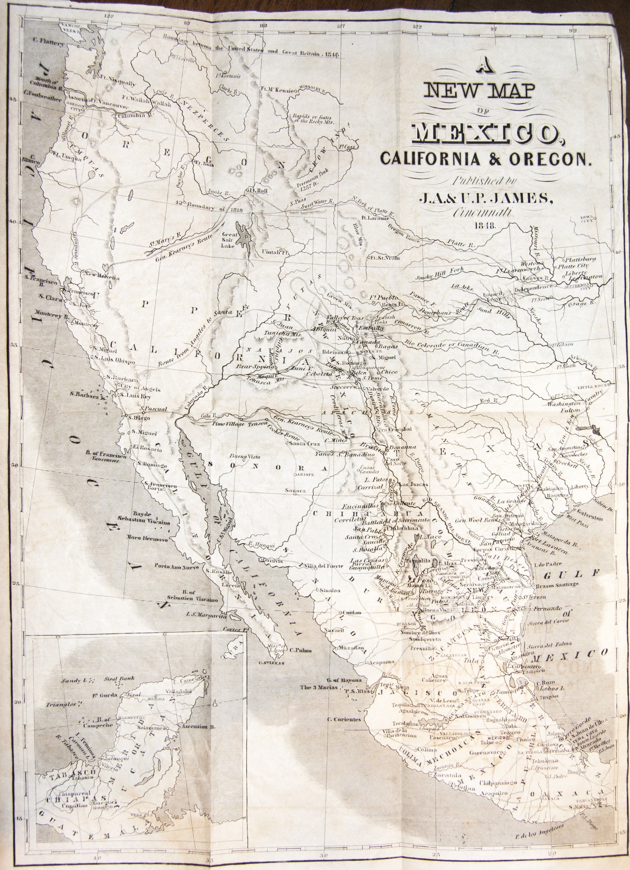
Description: The map shows the routes of Doniphan, Gen. Kearney, Gen. Taylor, Gilpin, Cooke, Arkansas Cavalry, Tennessee and Kentucky Cavalry, Gen. Patterson. It has good details for Baja California and an inset of Yucatan.
Title: A New Map of Mexico, California & Oregon. Published by J.A.& U.P. James, Cincinnati, 1848.
Credit: UTA Libraries A Continent Divided
Author: John T. Hughes
Usage Terms: Public domain
License: Public domain
Attribution Required?: No
Image usage
The following page links to this image:

All content from Kiddle encyclopedia articles (including the article images and facts) can be freely used under Attribution-ShareAlike license, unless stated otherwise.