
Image: Upper Mississippi River Valley AVA
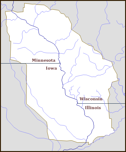
Description: Map of the Upper Mississippi River from its confluence with the St. Croix River at Prescott, Wisconsin 44°44′45″N 92°48′10″W / 44.745833°N 92.802778°W / 44.745833; -92.802778 downstream to its confluence with the Rock River at Rock Island, Illinois 41°28′56″N 90°37′05″W / 41.482310°N 90.618094°W / 41.482310; -90.618094 highlighting the 29,914 square mile (77,477 square kilometer) Upper Mississippi River Valley American Viticultural Area in northwest Illinois, northeast Iowa, southeast Minnesota and southwest Wisconsin.
Title: Upper Mississippi River Valley AVA
Credit: Own work
Author: Drdpw
Usage Terms: Creative Commons Attribution-Share Alike 3.0
License: CC BY-SA 3.0
License Link: https://creativecommons.org/licenses/by-sa/3.0
Attribution Required?: Yes
Image usage
The following page links to this image:
