
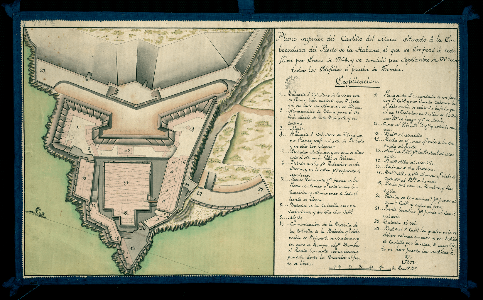
Image: Upper View of the Castillo del Morro Situated at the Mouth of the Bay of Havana WDL10088
Description: This 18th-century manuscript map shows the plan of Morro Castle, located at the entrance of Havana Bay, Cuba. The fortress was built by the Spaniards, starting in 1585. The Italian military engineer Battista Antonelli (1547–1616) was commissioned to design the fortifications. The structure originally was conceived as a small fort surrounded by a dry moat, but it was expanded and rebuilt on several occasions and became a major fortress of great strategic importance for the island. The map is oriented with north to the left and tilted up at an acute angle. On the right side are the title and an “Explanation” that indicates, through a numeric code, the fort’s bastions, bridges, cisterns, and batteries, with brief descriptions of some of these features. The map is drawn in pen on paper, with scale drawings in black ink and background in gray, pink, green, and orange sepia. Architectural drawings; Forts and fortifications; Manuscript maps
Title: Upper View of the Castillo del Morro Situated at the Mouth of the Bay of Havana
Credit: http://dl.wdl.org/10088.png Gallery: http://www.wdl.org/en/item/10088/
Usage Terms: Public domain
License: Public domain
Attribution Required?: No
Image usage
The following page links to this image:
