
Image: Velsen

Size of this preview: 678 × 600 pixels. Other resolutions: 271 × 240 pixels | 1,516 × 1,341 pixels.
Original image (1,516 × 1,341 pixels, file size: 346 KB, MIME type: image/gif)
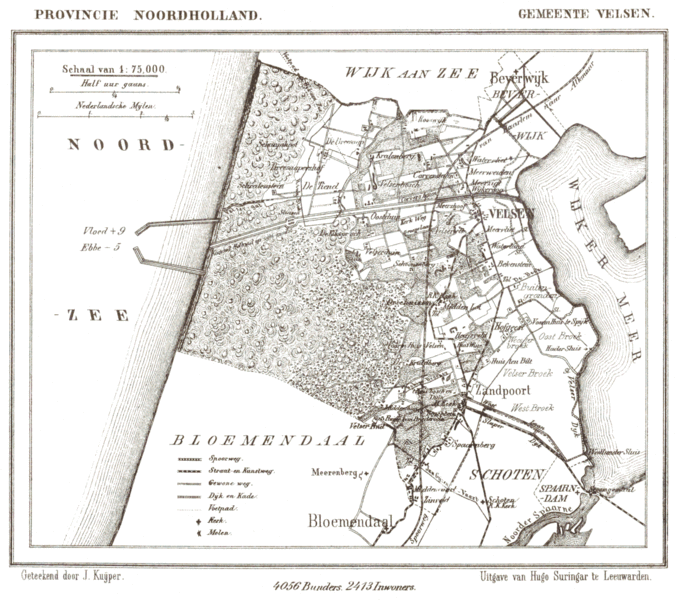
Description: Historic map of municipality Velsen, North Holland, the Netherlands, in 1867. The North Sea Canal is shown as planned and partially under construction. Historic map of Velsen showing the western portion of the IJ and the planned route of the canal.
Title: Velsen
Usage Terms: Public domain
License: Public domain
Attribution Required?: No
Image usage
The following page links to this image:

All content from Kiddle encyclopedia articles (including the article images and facts) can be freely used under Attribution-ShareAlike license, unless stated otherwise.