
Image: Verlaufskarte Inn DE

Size of this preview: 674 × 599 pixels. Other resolutions: 270 × 240 pixels | 2,117 × 1,882 pixels.
Original image (2,117 × 1,882 pixels, file size: 1.91 MB, MIME type: image/png)
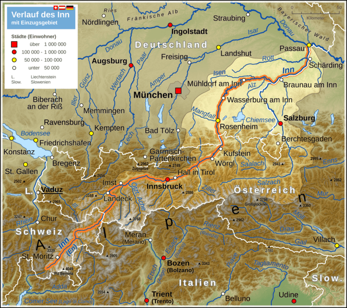
Description: Map of Inn river (including drainage basin)
Title: Verlaufskarte Inn DE
Credit: Own work Map created using: Generic Mapping Tools (GMT) with SRTM3 V2 data OpenStreetMap data File:Flag of Switzerland.svg File:Flag of Austria.svg File:Flag of Germany.svg
Author: Thoroe
Permission: Map data (c) OpenStreetMap (and) contributors, CC-BY-SA
Usage Terms: Creative Commons Attribution-Share Alike 2.0
License: CC BY-SA 2.0
License Link: https://creativecommons.org/licenses/by-sa/2.0
Attribution Required?: Yes
Image usage
The following page links to this image:

All content from Kiddle encyclopedia articles (including the article images and facts) can be freely used under Attribution-ShareAlike license, unless stated otherwise.