
Image: Victorian-railway-network-map

Size of this PNG preview of this SVG file: 800 × 553 pixels. Other resolution: 320 × 221 pixels.
Original image (SVG file, nominally 6,821 × 4,713 pixels, file size: 696 KB)
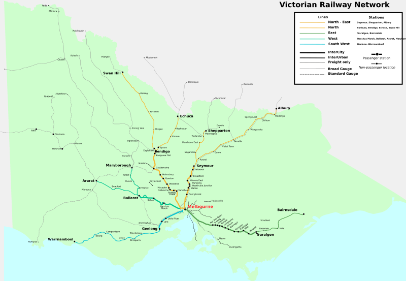
Description: Map of the railway network of Victoria, Australia for 2014. Excludes suburban network as seen in :Image:Melbourne_railways_map.gif, as well as V/Line passenger stations close to Geelong and Ballarat. Lines are grouped by V/Line Interurban / Intercity classifications, and region groupings. Freight and tourist railway lines also included. Track gauge is as well.
Author: Marcus Wong Wongm
Usage Terms: Creative Commons Attribution-Share Alike 3.0
License: CC-BY-SA-3.0
License Link: http://creativecommons.org/licenses/by-sa/3.0/
Attribution Required?: Yes
Image usage
The following page links to this image:

All content from Kiddle encyclopedia articles (including the article images and facts) can be freely used under Attribution-ShareAlike license, unless stated otherwise.