
Image: Vilnius 1576

Size of this preview: 800 × 592 pixels. Other resolutions: 320 × 237 pixels | 2,667 × 1,973 pixels.
Original image (2,667 × 1,973 pixels, file size: 1.76 MB, MIME type: image/jpeg)
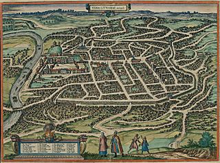
Description: Map of Vilnius in 1576
Title: Vilnius 1576
Credit: Original publication: Cities of the World (Civitates orbis terrarum. Koeln, 1581. T.3) Digital file: Historic Cities Center of the Department of Geography, the Hebrew University of Jerusalem and the Jewish National and University Library.
Author: German cartographer and church diplomat G. Braun (1541-1622) and his assistants
Permission: public domain (pd-old)
Usage Terms: Public domain
License: Public domain
Attribution Required?: No
Image usage
The following page links to this image:

All content from Kiddle encyclopedia articles (including the article images and facts) can be freely used under Attribution-ShareAlike license, unless stated otherwise.