
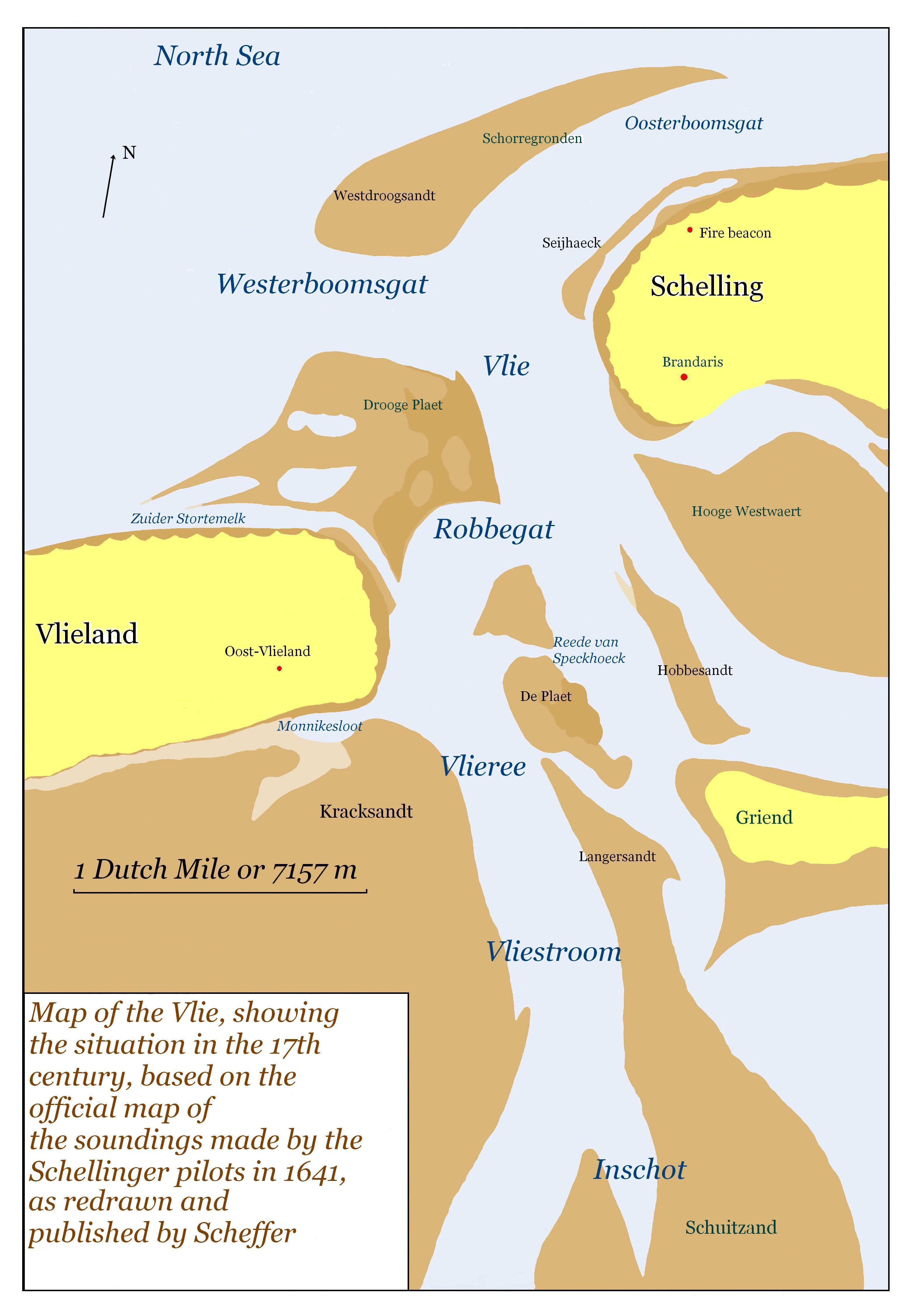
Image: Vlie9
Size of this preview: 410 × 599 pixels. Other resolutions: 164 × 240 pixels | 3,088 × 4,510 pixels.
Original image (3,088 × 4,510 pixels, file size: 668 KB, MIME type: image/jpeg)
Description: Map of Vlie area, based on the 1641 map made by the Schellinger pilots
Title: Vlie9
Credit: Own work
Author: MWAK
Usage Terms: Public domain
License: Public domain
Attribution Required?: No
Image usage
The following page links to this image:

All content from Kiddle encyclopedia articles (including the article images and facts) can be freely used under Attribution-ShareAlike license, unless stated otherwise.