
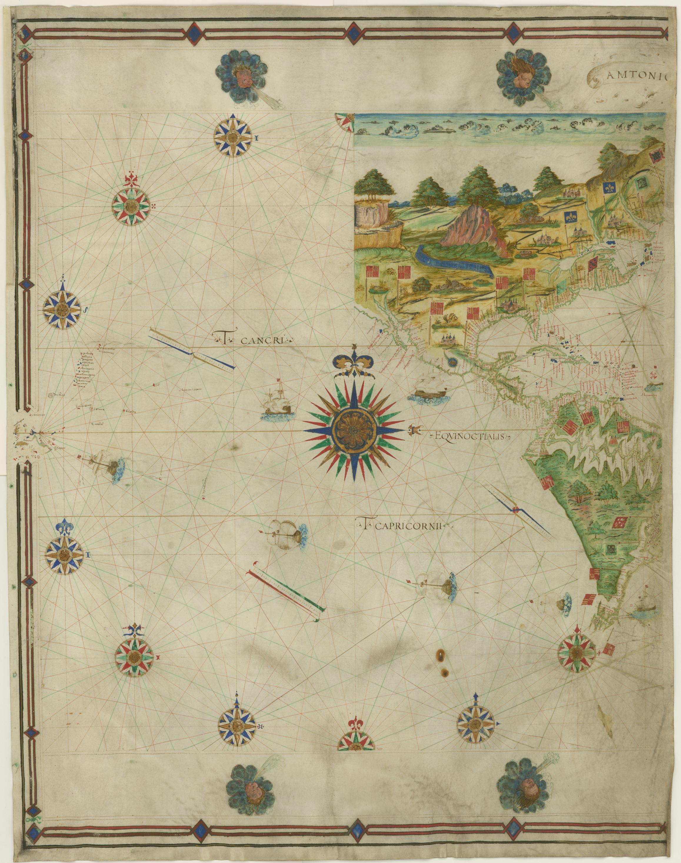
Image: Voyage of Francisco de Orellana Map by António Pereira 1546
Description: Early representation of Newfoundland, Lower California, the Amazon, and the Ladrones. "This is one of the earliest maps to show the results of Spanish exploration of the interior of North and South America. On the continent of South America is recorded Francisco de Orellana's great trek between 1539 and 1542. Starting at Quito, Orellana traveled across the Andes to the Amazon and down that great river to its mouth. Originally in three parts, this map has been attributed to António Pereira, a Portuguese seaman. The other two sections have not, as yet, been found." Description from Danforth, Susan., and William Hardy McNeill. Encountering the New World, 1493 to 1800: Catalogue of an Exhibition. Providence, RI: John Carter Brown Library, 1991, 17.
Title: Voyage of Francisco de Orellana Map by António Pereira 1546
Credit: John Carter Brown Library
Author: Pereira, António, active 16th century
Usage Terms: Public domain
License: Public domain
Attribution Required?: No
Image usage
The following page links to this image:
