
Image: WGSRPD Indian Subcontinent

Size of this preview: 533 × 600 pixels. Other resolutions: 213 × 240 pixels | 3,669 × 4,130 pixels.
Original image (3,669 × 4,130 pixels, file size: 836 KB, MIME type: image/png)
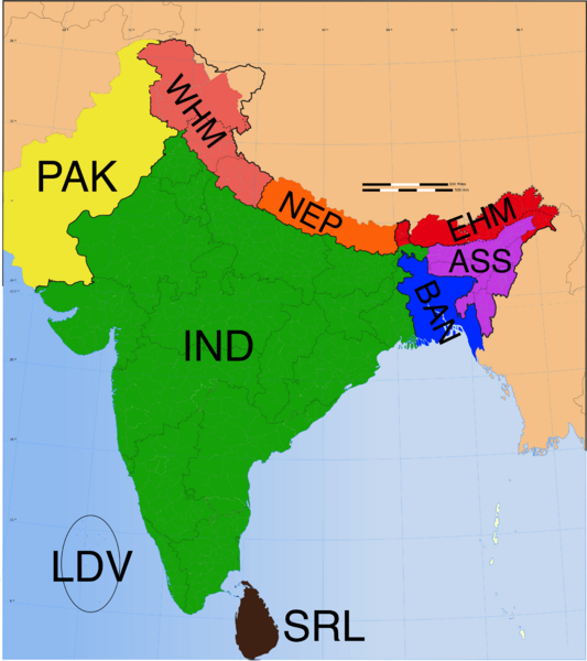
Description: The Indian Subcontinent, as defined by the World Geographical Scheme for Recording Plant Distributions. Yellow = Pakistan (not all shown) Pink = West Himalaya Orange = Nepal Red = East Himalaya Purple = Assam (region) – larger than the state Blue = Bangladesh Green = India (region) – not the country as a whole Brown = Sri Lanka Oval: Lakshadweep (Laccadive Islands) Not shown: Maldives
Title: WGSRPD Indian Subcontinent
Credit: Own work
Author: Rkitko
Usage Terms: Creative Commons Attribution-Share Alike 4.0
License: CC BY-SA 4.0
License Link: https://creativecommons.org/licenses/by-sa/4.0
Attribution Required?: Yes
Image usage
The following page links to this image:

All content from Kiddle encyclopedia articles (including the article images and facts) can be freely used under Attribution-ShareAlike license, unless stated otherwise.