
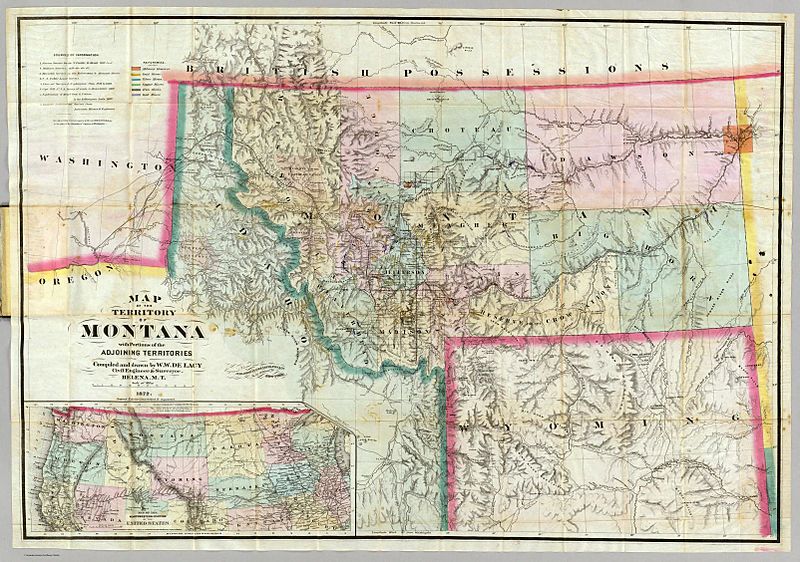
Image: W deLacy Map Montana 1872

Size of this preview: 800 × 562 pixels. Other resolutions: 320 × 225 pixels | 1,604 × 1,127 pixels.
Original image (1,604 × 1,127 pixels, file size: 413 KB, MIME type: image/jpeg)
Description: 1872 Map of Montana Territory, by Walter W. de Lacy
Title: W deLacy Map Montana 1872
Credit: http://www.davidrumsey.com/maps1724.html
Author: Walter W. de Lacy (1872)
Usage Terms: Public domain
License: Public domain
Attribution Required?: No
Image usage
The following page links to this image:

All content from Kiddle encyclopedia articles (including the article images and facts) can be freely used under Attribution-ShareAlike license, unless stated otherwise.