
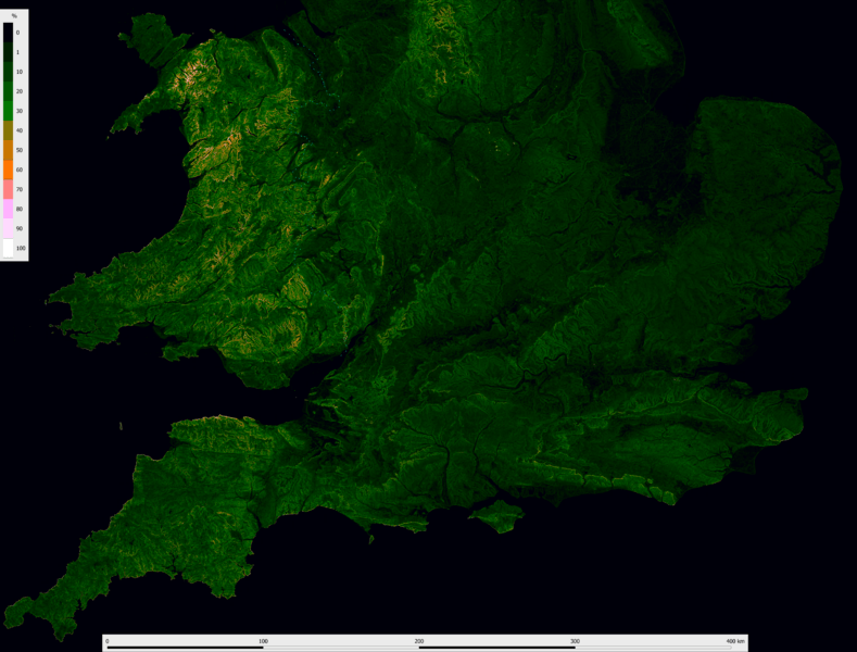
Image: Wales, Central and S England slope map 50 m

Size of this preview: 789 × 600 pixels. Other resolutions: 316 × 240 pixels | 14,873 × 11,310 pixels.
Original image (14,873 × 11,310 pixels, file size: 69.81 MB, MIME type: image/png)
Description: Elevation, specifically "slope", map resolved to 50 m. Even at sea each mean sea level is colour-coded. Calculated in MicroDEM from OS Terrain 50 DTM Grid by steepest downhill neighbour algorithm giving the steepest slope from slopes between a pixel and its lower neighbour(s). Colored in QGIS. The seashore is from OS Boundary-Line.
Title: Wales, Central and S England slope map 50 m
Credit: Own work
Author: PawełS
Usage Terms: Creative Commons Attribution-Share Alike 4.0
License: CC BY-SA 4.0
License Link: https://creativecommons.org/licenses/by-sa/4.0
Attribution Required?: Yes
Image usage
The following 2 pages link to this image:

All content from Kiddle encyclopedia articles (including the article images and facts) can be freely used under Attribution-ShareAlike license, unless stated otherwise.