
Image: WalkerExpeditionMarker
Size of this preview: 800 × 424 pixels. Other resolutions: 320 × 170 pixels | 1,960 × 1,040 pixels.
Original image (1,960 × 1,040 pixels, file size: 598 KB, MIME type: image/jpeg)
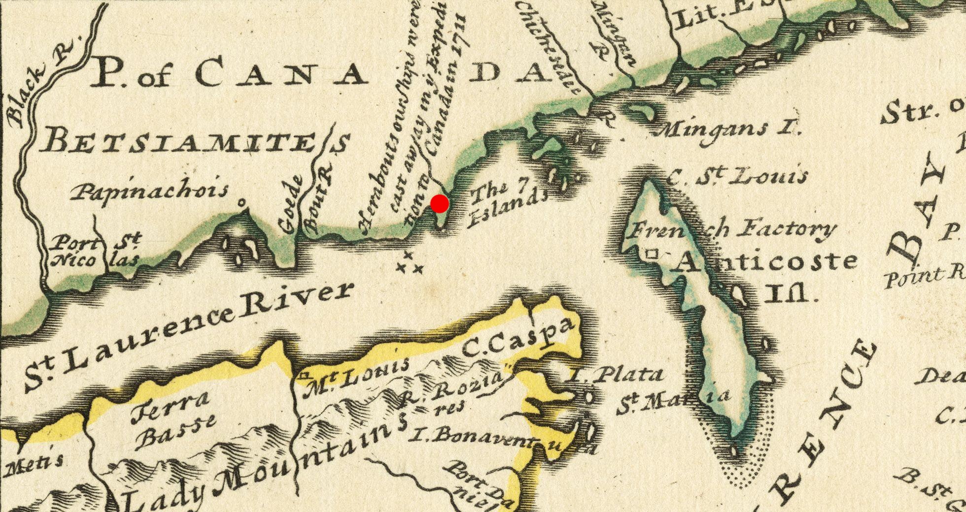
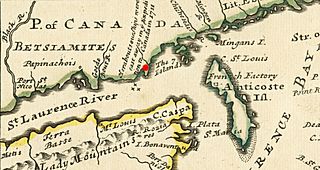
Description: A period map marked with the site of the 1711 Quebec Expedition naval disaster.
Title: WalkerExpeditionMarker
Credit: From the Boston Public Library digital map collection: http://maps.bpl.org/details_14080/ Call Number: G3400 1732 .M65
Author: Herman Moll
Usage Terms: Public domain
License: Public domain
Attribution Required?: No
Image usage
The following 2 pages link to this image:

All content from Kiddle encyclopedia articles (including the article images and facts) can be freely used under Attribution-ShareAlike license, unless stated otherwise.