
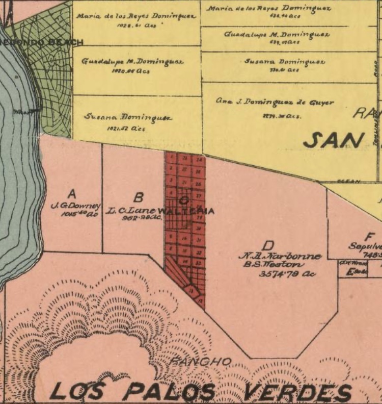
Image: Walteria 1888
Description: Walteria 1888
Title: Walteria 1888
Credit: Official map of Los Angeles County, California : compiled under instructions and by the order of the Board of Supervisors of Los Angeles County Names Rowan, V. J. (Valentine James) Schmidt Label & Litho. Co. Created / Published San Francisco, Cal. : Schmidt Label & Litho. Co., 1888. Headings - Los Angeles County (Calif.)--Maps - Real property--California--Los Angeles County--Maps - Landowners--California--Los Angeles County--Maps - United States--California--Los Angeles County Genre Maps Cadastral maps Notes - Relief shown by hachures. - Cadastral map showing drainage, roads, railroads, ranchos, township & section lines, land ownership, landowners' names, etc. - "Entered according to Act of Congress in the year 1888, by V.J. Rowan, in the office of the Librarian of Congress, at Washington, D.C." - Includes view of the Los Angeles County Court House and col. ill. - LC Land ownership maps, 23 - Available also through the Library of Congress Web site as a raster image. Medium 1 map on 8 sheets : hand col., cloth backing ; 179 x 151 cm. Call Number/Physical Location G4363.L6 1888 .R6 Repository Library of Congress Geography and Map Division Washington, D.C. 20540-4650 USA dcu Digital Id http://hdl.loc.gov/loc.gmd/g4363l.la000023 Library of Congress Control Number 2012590104 Online Format image LCCN Permalink https://lccn.loc.gov/2012590104
Author: County of Los Angeles
Usage Terms: Public domain
License: Public domain
Attribution Required?: No
Image usage
The following page links to this image:
