
Image: Watson Brake Mounds - Map
Size of this preview: 610 × 600 pixels. Other resolutions: 244 × 240 pixels | 1,509 × 1,484 pixels.
Original image (1,509 × 1,484 pixels, file size: 297 KB, MIME type: image/png)
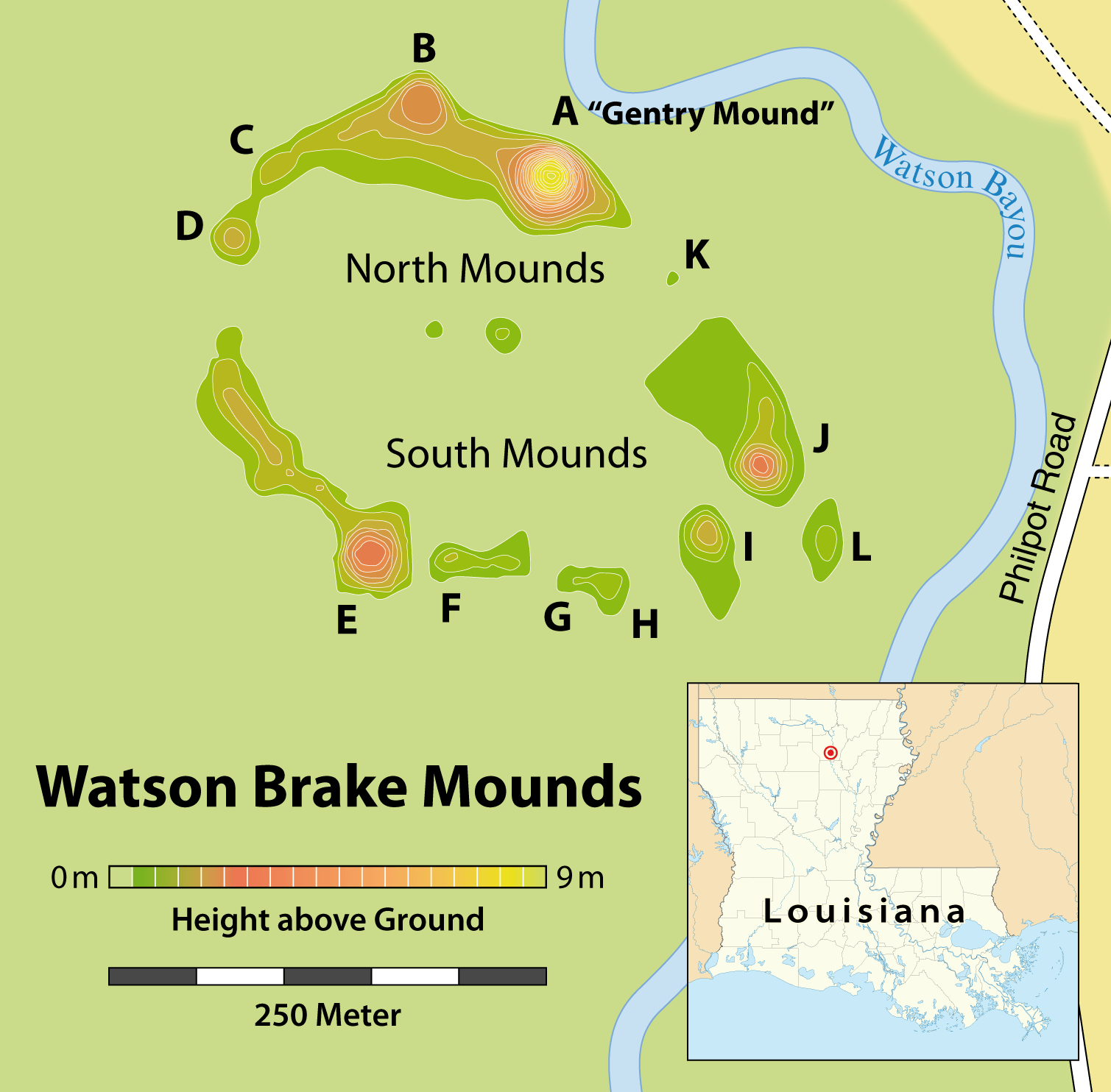
Description: Map of the Watson Brake archaeological site
Title: Watson Brake Mounds - Map
Credit: Self made, using Joe W. Saunders, Rolfe D. Mandel, et al.: Watson Brake, a Middle Archaic Mound Complex in Northeast Louisiana. In: American Antiquity, Vol. 70, No. 4 (Oktober 2005), pages 631-668 [634] this orientation map by Alexrk2
Author: Maximilian Dörrbecker (Chumwa)
Permission: I, the copyright holder of this work, hereby publish it under the following license:
Usage Terms: Creative Commons Attribution-Share Alike 2.5
License: CC BY-SA 2.5
License Link: https://creativecommons.org/licenses/by-sa/2.5
Attribution Required?: Yes
Image usage
The following page links to this image:

All content from Kiddle encyclopedia articles (including the article images and facts) can be freely used under Attribution-ShareAlike license, unless stated otherwise.